Leuchtenberg geodata
Leuchtenberg (Bavaria) is a populated place; located in Germany in Europe/Berlin (GMT+2) time zone. With population of 1,299 people, there are 6309 cities with bigger population in this country. Compared to other cities in Germany, 73.9% of cities are located further ↑North; 85.3% of cities are located further ←West and 93.3% of cities have lower elevation than Leuchtenberg. Note1
Administrative division(s):
- Level 1: Bavaria
- Level 2: Upper Palatinate
- Level 3: Landkreis Neustadt an der Waldnaab
- Level 4: Leuchtenberg, Markt


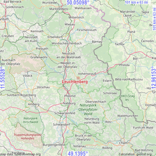
Leuchtenberg GPS coordinates[2]
49° 35' 50.532" North, 12° 15' 30.24" East
| Map corner | latitude | longitude |
|---|---|---|
| Upper-left | 50.05098°, | 11.55528° |
| Center: | 49.59737°, | 12.2584° |
| Lower-right: | 49.1395°, | 12.96153° |
| Map W x H: | 101.3×101.3 km | = 62.9×62.9mi |
| max Lat: | 55.01917° ⇑73.9% North |
| Leuchtenberg: | 49.59737° |
| min Lat: | ⇓26.1% South 47.40724° |
| min Long | Leuchtenberg | max Long |
| 5.92978° | 12.2584° | 14.98853° |
| W 85.3%⇐ | ⇒14.7% E |
Elevation
Elevation of Leuchtenberg is 563 m = 1847 ft, and this is 313.9 m = 1030 ft above average elevation for this country.
| Max E: |
1256 m = 4121 ft | 6.7% |
| Leuchtenberg | 563 m 1847 ft | |
| Avg. | 249.1 m = 817 ft | |
Min E: |
-5 m = -16 ft | 93.3% |
See also: Germany elevation on elevation.city.
Geographical zone
Leuchtenberg is located in North temperate zone (between Tropic of Cancer and the Arctic Circle). Distance of this North polar circle is 1886.5 km =1172.2 mi to North.| Distance of | km | miles | from Leuchtenberg |
|---|---|---|---|
| North Pole | 4492.4 | 2791.4 | to North |
| Arctic Circle | 1886.5 | 1172.2 | to North |
| Tropic Cancer | 2908.8 | 1807.4 | to South |
| Equator | 5514.7 | 3426.7 | to South |


Nearby cities:
15 places around Leuchtenberg: (largest is in red/bold)
• Bechtsrieth
6.3 km =3.9 mi,  326°
326°
• Gleiritsch
11.9 km =7.4 mi,  159°
159°
• Irchenrieth
3.7 km =2.3 mi,  319°
319°
• Luhe-Wildenau
8 km =5 mi,  259°
259°
• Moosbach
11 km =6.8 mi,  94°
94°
• Pirk
7.7 km =4.8 mi,  301°
301°
• Pleystein
12.1 km =7.5 mi,  61°
61°
• Schirmitz
8.8 km =5.5 mi,  311°
311°
• Theisseil
10.6 km =6.6 mi,  347°
347°
• Trausnitz
8.5 km =5.3 mi,  178°
178°
• Tännesberg
8.8 km =5.5 mi,  145°
145°
• Vohenstrauß
6.5 km =4 mi, 62°
• Waldthurn
9.8 km =6.1 mi,  31°
31°
• Weiden
11.5 km =7.1 mi, 320°
• Wernberg-Köblitz
9.5 km =5.9 mi,  227°
227°
Sources, notices
• [Note1] Compared only with cities in Germany existing in our database
• [Src1] Map data: © OpenStreetMap contributors (CC-BY-SA)
• [Src2] Other city data from geonames.org with taken over terms of usage.
• [Src3] Geographical zone / Annual Mean Temperature by Robert A. Rohde @ Wikipedia
