Bechtsrieth geodata
Bechtsrieth (Bavaria) is a seat of a fourth-order administrative division; located in Germany in Europe/Berlin (GMT+2) time zone. With population of 1,096 people, there are 6855 cities with bigger population in this country. Compared to other cities in Germany, 72.7% of cities are located further ↑North; 84.8% of cities are located further ←West and 82.1% of cities have lower elevation than Bechtsrieth. Note1
Administrative division(s):
- Level 1: Bavaria
- Level 2: Upper Palatinate
- Level 3: Landkreis Neustadt an der Waldnaab
- Level 4: Bechtsrieth


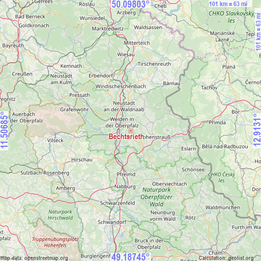
Bechtsrieth GPS coordinates[2]
49° 38' 41.532" North, 12° 12' 35.892" East
| Map corner | latitude | longitude |
|---|---|---|
| Upper-left | 50.09803°, | 11.50685° |
| Center: | 49.64487°, | 12.20997° |
| Lower-right: | 49.18745°, | 12.9131° |
| Map W x H: | 101.2×101.2 km | = 62.9×62.9mi |
| max Lat: | 55.01917° ⇑72.7% North |
| Bechtsrieth: | 49.64487° |
| min Lat: | ⇓27.3% South 47.40724° |
| min Long | Bechtsrieth | max Long |
| 5.92978° | 12.20997° | 14.98853° |
| W 84.8%⇐ | ⇒15.2% E |
Elevation
Elevation of Bechtsrieth is 447 m = 1467 ft, and this is 197.9 m = 649 ft above average elevation for this country.
| Max E: |
1256 m = 4121 ft | 17.9% |
| Bechtsrieth | 447 m 1467 ft | |
| Avg. | 249.1 m = 817 ft | |
Min E: |
-5 m = -16 ft | 82.1% |
See also: Germany elevation on elevation.city.
Geographical zone
Bechtsrieth is located in North temperate zone (between Tropic of Cancer and the Arctic Circle). Distance of this North polar circle is 1881.2 km =1168.9 mi to North.| Distance of | km | miles | from Bechtsrieth |
|---|---|---|---|
| North Pole | 4487.1 | 2788.2 | to North |
| Arctic Circle | 1881.2 | 1168.9 | to North |
| Tropic Cancer | 2914.1 | 1810.7 | to South |
| Equator | 5520 | 3430 | to South |


Nearby cities:
15 places around Bechtsrieth: (largest is in red/bold)
• Etzenricht
8 km =5 mi,  260°
260°
• Floß
10 km =6.2 mi,  28°
28°
• Irchenrieth
2.7 km =1.7 mi,  156°
156°
• Leuchtenberg
6.3 km =3.9 mi,  146°
146°
• Luhe-Wildenau
8.1 km =5 mi,  212°
212°
• Neustadt an der Waldnaab
10.1 km =6.3 mi,  346°
346°
• Pirk
3.4 km =2.1 mi,  247°
247°
• Püchersreuth
11.8 km =7.3 mi,  8°
8°
• Schirmitz
3.2 km =2 mi,  280°
280°
• Störnstein
9.7 km =6 mi,  358°
358°
• Theisseil
5.2 km =3.2 mi, 13°
• Vohenstrauß
9.5 km =5.9 mi,  104°
104°
• Waldthurn
9.1 km =5.7 mi,  70°
70°
• Weiden
5.3 km =3.3 mi,  312°
312°
• Weiherhammer
10.4 km =6.5 mi, 262°
Sources, notices
• [Note1] Compared only with cities in Germany existing in our database
• [Src1] Map data: © OpenStreetMap contributors (CC-BY-SA)
• [Src2] Other city data from geonames.org with taken over terms of usage.
• [Src3] Geographical zone / Annual Mean Temperature by Robert A. Rohde @ Wikipedia
