Utarp geodata
Utarp (Lower Saxony) is a seat of a fourth-order administrative division; located in Germany in Europe/Berlin (GMT+2) time zone. With population of 655 people, there are 8532 cities with bigger population in this country. Compared to other cities in Germany, 87.2% of cities are located further ↓South; 87.4% of cities are located further →East and 99.8% of cities have higher elevation than Utarp. Note1


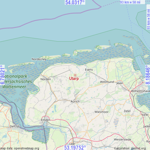
Utarp GPS coordinates[2]
53° 37' 0.012" North, 7° 28' 59.988" East
| Map corner | latitude | longitude |
|---|---|---|
| Upper-left | 54.0317°, | 6.78021° |
| Center: | 53.61667°, | 7.48333° |
| Lower-right: | 53.19752°, | 8.18646° |
| Map W x H: | 92.8×92.7 km | = 57.7×57.6mi |
| max Lat: | 55.01917° ⇑12.8% North |
| Utarp: | 53.61667° |
| min Lat: | ⇓87.2% South 47.40724° |
| min Long | Utarp | max Long |
| 5.92978° | 7.48333° | 14.98853° |
| W 12.6%⇐ | ⇒87.4% E |
Elevation
Elevation of Utarp is -2 m = -7 ft, and this is 251.1 m = 824 ft below average elevation for this country.
| Max E: |
1256 m = 4121 ft | 99.8% |
| Avg. | 249.1 m = 817 ft | |
| Utarp | -2 m = -7 ft | |
Min E: |
-5 m = -16 ft | 0.2% |
See also: Germany elevation on elevation.city.
Geographical zone
Utarp is located in North temperate zone (between Tropic of Cancer and the Arctic Circle). Distance of this North polar circle is 1439.6 km =894.5 mi to North.| Distance of | km | miles | from Utarp |
|---|---|---|---|
| North Pole | 4045.4 | 2513.7 | to North |
| Arctic Circle | 1439.6 | 894.5 | to North |
| Tropic Cancer | 3355.7 | 2085.1 | to South |
| Equator | 5961.6 | 3704.4 | to South |


Nearby cities:
15 places around Utarp: (largest is in red/bold)
• Bensersiel
8.8 km =5.5 mi,  45°
45°
• Berumbur
11.1 km =6.9 mi,  260°
260°
• Blomberg
6.6 km =4.1 mi,  131°
131°
• Dornum
4.9 km =3 mi,  313°
313°
• Dunum
11.2 km =7 mi,  99°
99°
• Esens
9.2 km =5.7 mi,  67°
67°
• Eversmeer
7.1 km =4.4 mi,  207°
207°
• Hagermarsch
12.6 km =7.8 mi,  287°
287°
• Holtgast
6.2 km =3.9 mi,  76°
76°
• Moorweg
6.8 km =4.2 mi, 74°
• Nenndorf
5 km =3.1 mi,  221°
221°
• Ostochtersum
3.1 km =1.9 mi,  112°
112°
• Schweindorf
2.2 km =1.4 mi, 210°
• Stedesdorf
12.2 km =7.6 mi, 81°
• Westerholt
2.9 km =1.8 mi,  229°
229°
Sources, notices
• [Note1] Compared only with cities in Germany existing in our database
• [Src1] Map data: © OpenStreetMap contributors (CC-BY-SA)
• [Src2] Other city data from geonames.org with taken over terms of usage.
• [Src3] Geographical zone / Annual Mean Temperature by Robert A. Rohde @ Wikipedia
