Schweindorf geodata
Schweindorf (Lower Saxony) is a seat of a fourth-order administrative division; located in Germany in Europe/Berlin (GMT+2) time zone. In our database, there are 11009 cities with bigger population. Compared to other cities in Germany, 86.9% of cities are located further ↓South; 87.7% of cities are located further →East and 97.6% of cities have higher elevation than Schweindorf. Note1


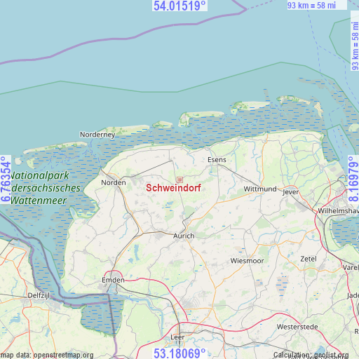
Schweindorf GPS coordinates[2]
53° 36' 0" North, 7° 28' 0.012" East
| Map corner | latitude | longitude |
|---|---|---|
| Upper-left | 54.01519°, | 6.76354° |
| Center: | 53.6°, | 7.46667° |
| Lower-right: | 53.18069°, | 8.16979° |
| Map W x H: | 92.8×92.8 km | = 57.7×57.7mi |
| max Lat: | 55.01917° ⇑13.1% North |
| Schweindorf: | 53.6° |
| min Lat: | ⇓86.9% South 47.40724° |
| min Long | Schweindorf | max Long |
| 5.92978° | 7.46667° | 14.98853° |
| W 12.3%⇐ | ⇒87.7% E |
Elevation
Elevation of Schweindorf is 3 m = 10 ft, and this is 246.1 m = 807 ft below average elevation for this country.
| Max E: |
1256 m = 4121 ft | 97.6% |
| Avg. | 249.1 m = 817 ft | |
| Schweindorf | 3 m = 10 ft | |
Min E: |
-5 m = -16 ft | 2.4% |
See also: Germany elevation on elevation.city.
Geographical zone
Schweindorf is located in North temperate zone (between Tropic of Cancer and the Arctic Circle). Distance of this North polar circle is 1441.4 km =895.6 mi to North.| Distance of | km | miles | from Schweindorf |
|---|---|---|---|
| North Pole | 4047.3 | 2514.9 | to North |
| Arctic Circle | 1441.4 | 895.6 | to North |
| Tropic Cancer | 3353.8 | 2084 | to South |
| Equator | 5959.8 | 3703.2 | to South |


Nearby cities:
15 places around Schweindorf: (largest is in red/bold)
• Bensersiel
10.9 km =6.8 mi,  42°
42°
• Berumbur
9.9 km =6.2 mi,  270°
270°
• Blomberg
6.6 km =4.1 mi,  113°
113°
• Dornum
5.7 km =3.5 mi,  334°
334°
• Dunum
12.1 km =7.5 mi,  90°
90°
• Esens
11 km =6.8 mi,  60°
60°
• Eversmeer
5 km =3.1 mi,  206°
206°
• Hage
12 km =7.5 mi, 271°
• Holtgast
7.9 km =4.9 mi,  65°
65°
• Moorweg
8.5 km =5.3 mi, 64°
• Nenndorf
2.9 km =1.8 mi,  229°
229°
• Ostochtersum
4 km =2.5 mi,  80°
80°
• Rechtsupweg
11.5 km =7.1 mi, 229°
• Utarp
2.2 km =1.4 mi,  30°
30°
• Westerholt
1.1 km =0.7 mi, 270°
Sources, notices
• [Note1] Compared only with cities in Germany existing in our database
• [Src1] Map data: © OpenStreetMap contributors (CC-BY-SA)
• [Src2] Other city data from geonames.org with taken over terms of usage.
• [Src3] Geographical zone / Annual Mean Temperature by Robert A. Rohde @ Wikipedia
