Unnau geodata
Unnau (Rheinland-Pfalz) is a seat of a fourth-order administrative division; located in Germany in Europe/Berlin (GMT+2) time zone. With population of 1,932 people, there are 5165 cities with bigger population in this country. Compared to other cities in Germany, 50.7% of cities are located further ↓South; 78.8% of cities are located further →East and 73% of cities have lower elevation than Unnau. Note1


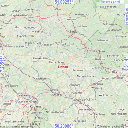
Unnau GPS coordinates[2]
50° 38' 55.716" North, 7° 54' 29.772" East
| Map corner | latitude | longitude |
|---|---|---|
| Upper-left | 51.09253°, | 7.20515° |
| Center: | 50.64881°, | 7.90827° |
| Lower-right: | 50.20086°, | 8.6114° |
| Map W x H: | 99.1×99.1 km | = 61.6×61.6mi |
| max Lat: | 55.01917° ⇑49.3% North |
| Unnau: | 50.64881° |
| min Lat: | ⇓50.7% South 47.40724° |
| min Long | Unnau | max Long |
| 5.92978° | 7.90827° | 14.98853° |
| W 21.2%⇐ | ⇒78.8% E |
Elevation
Elevation of Unnau is 382 m = 1253 ft, and this is 132.9 m = 436 ft above average elevation for this country.
| Max E: |
1256 m = 4121 ft | 27% |
| Unnau | 382 m 1253 ft | |
| Avg. | 249.1 m = 817 ft | |
Min E: |
-5 m = -16 ft | 73% |
See also: Germany elevation on elevation.city.
Geographical zone
Unnau is located in North temperate zone (between Tropic of Cancer and the Arctic Circle). Distance of this North polar circle is 1769.6 km =1099.6 mi to North.| Distance of | km | miles | from Unnau |
|---|---|---|---|
| North Pole | 4375.4 | 2718.7 | to North |
| Arctic Circle | 1769.6 | 1099.6 | to North |
| Tropic Cancer | 3025.7 | 1880.1 | to South |
| Equator | 5631.6 | 3499.3 | to South |


Nearby cities:
15 places around Unnau: (largest is in red/bold)
• Alpenrod
3.4 km =2.1 mi,  239°
239°
• Bad Marienberg
2.9 km =1.8 mi,  88°
88°
• Bellingen
5.5 km =3.4 mi,  186°
186°
• Bölsberg
2.1 km =1.3 mi,  16°
16°
• Dreisbach
4 km =2.5 mi,  153°
153°
• Enspel
4 km =2.5 mi,  206°
206°
• Großseifen
4.5 km =2.8 mi,  112°
112°
• Hahn bei Marienberg
2.9 km =1.8 mi,  127°
127°
• Hardt
1.8 km =1.1 mi,  161°
161°
• Kirburg
4.2 km =2.6 mi, 24°
• Langenbach bei Marienberg
3 km =1.9 mi, 113°
• Lautzenbrücken
4.8 km =3 mi,  55°
55°
• Norken
2.8 km =1.7 mi,  344°
344°
• Stockhausen-Illfurth
5.6 km =3.5 mi, 92°
• Stockum-Püschen
4.9 km =3 mi,  183°
183°
Sources, notices
• [Note1] Compared only with cities in Germany existing in our database
• [Src1] Map data: © OpenStreetMap contributors (CC-BY-SA)
• [Src2] Other city data from geonames.org with taken over terms of usage.
• [Src3] Geographical zone / Annual Mean Temperature by Robert A. Rohde @ Wikipedia
