Großseifen geodata
Großseifen (Rheinland-Pfalz) is a seat of a fourth-order administrative division; located in Germany in Europe/Berlin (GMT+2) time zone. With population of 577 people, there are 8939 cities with bigger population in this country. Compared to other cities in Germany, 50.3% of cities are located further ↓South; 77.8% of cities are located further →East and 83.2% of cities have lower elevation than Großseifen. Note1


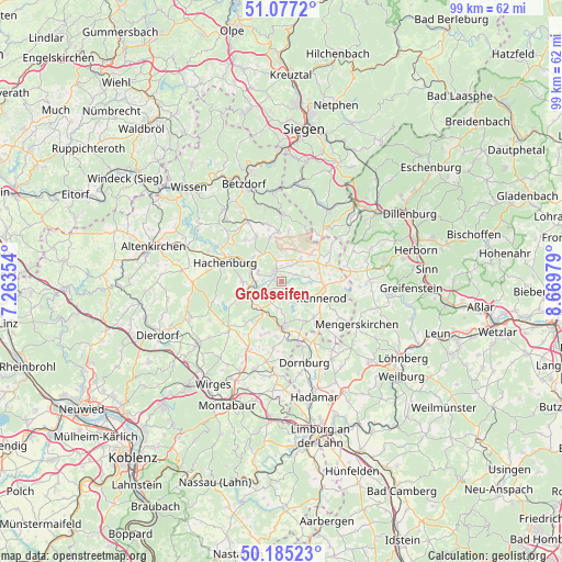
Großseifen GPS coordinates[2]
50° 37' 59.988" North, 7° 58' 0.012" East
| Map corner | latitude | longitude |
|---|---|---|
| Upper-left | 51.0772°, | 7.26354° |
| Center: | 50.63333°, | 7.96667° |
| Lower-right: | 50.18523°, | 8.66979° |
| Map W x H: | 99.2×99.2 km | = 61.6×61.6mi |
| max Lat: | 55.01917° ⇑49.7% North |
| Großseifen: | 50.63333° |
| min Lat: | ⇓50.3% South 47.40724° |
| min Long | Großseifen | max Long |
| 5.92978° | 7.96667° | 14.98853° |
| W 22.2%⇐ | ⇒77.8% E |
Elevation
Elevation of Großseifen is 455 m = 1493 ft, and this is 205.9 m = 676 ft above average elevation for this country.
| Max E: |
1256 m = 4121 ft | 16.8% |
| Großseifen | 455 m 1493 ft | |
| Avg. | 249.1 m = 817 ft | |
Min E: |
-5 m = -16 ft | 83.2% |
See also: Germany elevation on elevation.city.
Geographical zone
Großseifen is located in North temperate zone (between Tropic of Cancer and the Arctic Circle). Distance of this North polar circle is 1771.3 km =1100.6 mi to North.| Distance of | km | miles | from Großseifen |
|---|---|---|---|
| North Pole | 4377.2 | 2719.9 | to North |
| Arctic Circle | 1771.3 | 1100.6 | to North |
| Tropic Cancer | 3024 | 1879 | to South |
| Equator | 5629.9 | 3498.3 | to South |


Nearby cities:
15 places around Großseifen: (largest is in red/bold)
• Ailertchen
4.2 km =2.6 mi,  204°
204°
• Bad Marienberg
2.2 km =1.4 mi,  326°
326°
• Dreisbach
3 km =1.9 mi,  231°
231°
• Fehl-Ritzhausen
2.9 km =1.8 mi,  63°
63°
• Hahn bei Marienberg
1.8 km =1.1 mi,  268°
268°
• Halbs
4.7 km =2.9 mi,  181°
181°
• Hardt
3.5 km =2.2 mi, 270°
• Hellenhahn-Schellenberg
4.8 km =3 mi,  118°
118°
• Höhn
2.2 km =1.4 mi,  147°
147°
• Langenbach bei Marienberg
1.4 km =0.9 mi,  291°
291°
• Lautzenbrücken
4.5 km =2.8 mi,  357°
357°
• Niederroßbach
4.9 km =3 mi,  79°
79°
• Pottum
4.4 km =2.7 mi, 147°
• Stockhausen-Illfurth
2.1 km =1.3 mi,  44°
44°
• Unnau
4.5 km =2.8 mi, 292°
Sources, notices
• [Note1] Compared only with cities in Germany existing in our database
• [Src1] Map data: © OpenStreetMap contributors (CC-BY-SA)
• [Src2] Other city data from geonames.org with taken over terms of usage.
• [Src3] Geographical zone / Annual Mean Temperature by Robert A. Rohde @ Wikipedia
