Bölsberg geodata
Bölsberg (Rheinland-Pfalz) is a seat of a fourth-order administrative division; located in Germany in Europe/Berlin (GMT+2) time zone. With population of 300 people, there are 10048 cities with bigger population in this country. Compared to other cities in Germany, 51.1% of cities are located further ↓South; 78.7% of cities are located further →East and 87.8% of cities have lower elevation than Bölsberg. Note1


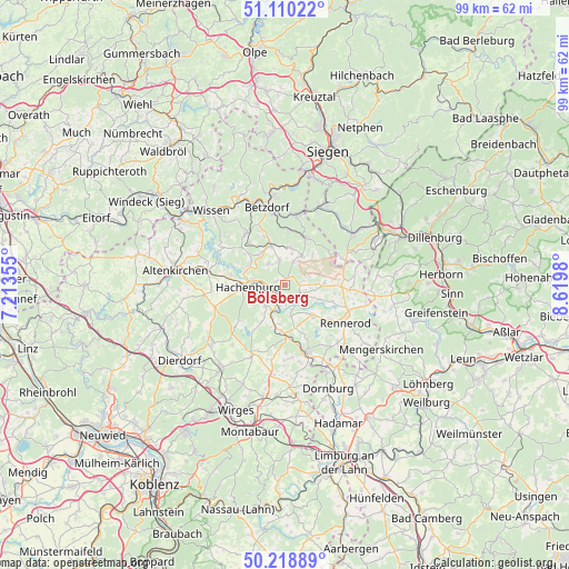
Bölsberg GPS coordinates[2]
50° 40' 0.012" North, 7° 55' 0.012" East
| Map corner | latitude | longitude |
|---|---|---|
| Upper-left | 51.11022°, | 7.21355° |
| Center: | 50.66667°, | 7.91667° |
| Lower-right: | 50.21889°, | 8.6198° |
| Map W x H: | 99.1×99.1 km | = 61.6×61.6mi |
| max Lat: | 55.01917° ⇑48.9% North |
| Bölsberg: | 50.66667° |
| min Lat: | ⇓51.1% South 47.40724° |
| min Long | Bölsberg | max Long |
| 5.92978° | 7.91667° | 14.98853° |
| W 21.3%⇐ | ⇒78.7% E |
Elevation
Elevation of Bölsberg is 492 m = 1614 ft, and this is 242.9 m = 797 ft above average elevation for this country.
| Max E: |
1256 m = 4121 ft | 12.2% |
| Bölsberg | 492 m 1614 ft | |
| Avg. | 249.1 m = 817 ft | |
Min E: |
-5 m = -16 ft | 87.8% |
See also: Germany elevation on elevation.city.
Geographical zone
Bölsberg is located in North temperate zone (between Tropic of Cancer and the Arctic Circle). Distance of this North polar circle is 1767.6 km =1098.3 mi to North.| Distance of | km | miles | from Bölsberg |
|---|---|---|---|
| North Pole | 4373.5 | 2717.6 | to North |
| Arctic Circle | 1767.6 | 1098.3 | to North |
| Tropic Cancer | 3027.7 | 1881.3 | to South |
| Equator | 5633.6 | 3500.6 | to South |


Nearby cities:
15 places around Bölsberg: (largest is in red/bold)
• Alpenrod
5.1 km =3.2 mi,  223°
223°
• Bad Marienberg
3 km =1.9 mi,  129°
129°
• Großseifen
5.1 km =3.2 mi,  136°
136°
• Hahn bei Marienberg
4.1 km =2.5 mi,  155°
155°
• Hardt
3.7 km =2.3 mi,  180°
180°
• Kirburg
2.2 km =1.4 mi,  32°
32°
• Langenbach bei Kirburg
3.9 km =2.4 mi,  17°
17°
• Langenbach bei Marienberg
3.9 km =2.4 mi,  145°
145°
• Lautzenbrücken
3.5 km =2.2 mi,  77°
77°
• Mörlen
4.2 km =2.6 mi,  326°
326°
• Nauroth
4.6 km =2.9 mi,  321°
321°
• Neunkhausen
4.6 km =2.9 mi,  347°
347°
• Nisterberg
5 km =3.1 mi,  68°
68°
• Norken
1.5 km =0.9 mi,  297°
297°
• Unnau
2.1 km =1.3 mi,  196°
196°
Sources, notices
• [Note1] Compared only with cities in Germany existing in our database
• [Src1] Map data: © OpenStreetMap contributors (CC-BY-SA)
• [Src2] Other city data from geonames.org with taken over terms of usage.
• [Src3] Geographical zone / Annual Mean Temperature by Robert A. Rohde @ Wikipedia
