Stockhausen-Illfurth geodata
Stockhausen-Illfurth (Rheinland-Pfalz) is a seat of a fourth-order administrative division; located in Germany in Europe/Berlin (GMT+2) time zone. With population of 486 people, there are 9432 cities with bigger population in this country. Compared to other cities in Germany, 50.6% of cities are located further ↓South; 77.3% of cities are located further →East and 89.2% of cities have lower elevation than Stockhausen-Illfurth. Note1
Administrative division(s):
- Level 1: Rheinland-Pfalz
- Level 3: Westerwaldkreis
- Level 4: Stockhausen-Illfurth


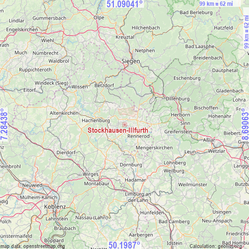
Stockhausen-Illfurth GPS coordinates[2]
50° 38' 48.012" North, 7° 59' 15" East
| Map corner | latitude | longitude |
|---|---|---|
| Upper-left | 51.09041°, | 7.28438° |
| Center: | 50.64667°, | 7.9875° |
| Lower-right: | 50.1987°, | 8.69063° |
| Map W x H: | 99.1×99.1 km | = 61.6×61.6mi |
| max Lat: | 55.01917° ⇑49.4% North |
| Stockhausen-Illfurth: | 50.64667° |
| min Lat: | ⇓50.6% South 47.40724° |
| min Long | Stockhausen-Ill | max Long |
| 5.92978° | 7.9875° | 14.98853° |
| W 22.7%⇐ | ⇒77.3% E |
Elevation
Elevation of Stockhausen-Illfurth is 505 m = 1657 ft, and this is 255.9 m = 840 ft above average elevation for this country.
| Max E: |
1256 m = 4121 ft | 10.8% |
| Stockhausen-Illfurth | 505 m 1657 ft | |
| Avg. | 249.1 m = 817 ft | |
Min E: |
-5 m = -16 ft | 89.2% |
See also: Germany elevation on elevation.city.
Geographical zone
Stockhausen-Illfurth is located in North temperate zone (between Tropic of Cancer and the Arctic Circle). Distance of this North polar circle is 1769.8 km =1099.7 mi to North.| Distance of | km | miles | from Stockhausen-Illfurth |
|---|---|---|---|
| North Pole | 4375.7 | 2718.9 | to North |
| Arctic Circle | 1769.8 | 1099.7 | to North |
| Tropic Cancer | 3025.5 | 1880 | to South |
| Equator | 5631.4 | 3499.2 | to South |


Nearby cities:
15 places around Stockhausen-Illfurth: (largest is in red/bold)
• Bad Marienberg
2.7 km =1.7 mi,  276°
276°
• Fehl-Ritzhausen
1.1 km =0.7 mi,  99°
99°
• Großseifen
2.1 km =1.3 mi,  224°
224°
• Hahn bei Marienberg
3.6 km =2.2 mi,  244°
244°
• Hellenhahn-Schellenberg
4.7 km =2.9 mi,  143°
143°
• Hof
3 km =1.9 mi,  42°
42°
• Höhn
3.3 km =2.1 mi,  185°
185°
• Langenbach bei Marienberg
3 km =1.9 mi,  251°
251°
• Lautzenbrücken
3.4 km =2.1 mi,  331°
331°
• Neustadt/Westerwald
4.2 km =2.6 mi,  116°
116°
• Niederroßbach
3.4 km =2.1 mi, 99°
• Nisterberg
4.1 km =2.5 mi,  355°
355°
• Oberroßbach
3.8 km =2.4 mi,  76°
76°
• Salzburg
4.9 km =3 mi,  63°
63°
• Zehnhausen bei Rennerod
5.1 km =3.2 mi,  89°
89°
Sources, notices
• [Note1] Compared only with cities in Germany existing in our database
• [Src1] Map data: © OpenStreetMap contributors (CC-BY-SA)
• [Src2] Other city data from geonames.org with taken over terms of usage.
• [Src3] Geographical zone / Annual Mean Temperature by Robert A. Rohde @ Wikipedia
