Uffing geodata
Uffing (Bavaria) is a populated place; located in Germany in Europe/Berlin (GMT+2) time zone. With population of 2,994 people, there are 4006 cities with bigger population in this country. Compared to other cities in Germany, 98.7% of cities are located further ↑North; 69.2% of cities are located further ←West and 96.9% of cities have lower elevation than Uffing. Note1
Administrative division(s):
- Level 1: Bavaria
- Level 2: Upper Bavaria
- Level 3: Landkreis Garmisch-Partenkirchen
- Level 4: Uffing am Staffelsee


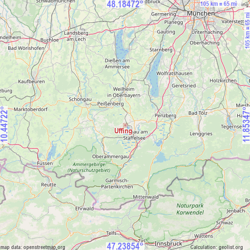
Uffing GPS coordinates[2]
47° 42' 49.608" North, 11° 9' 1.224" East
| Map corner | latitude | longitude |
|---|---|---|
| Upper-left | 48.18472°, | 10.44722° |
| Center: | 47.71378°, | 11.15034° |
| Lower-right: | 47.23854°, | 11.85347° |
| Map W x H: | 105.2×105.2 km | = 65.4×65.4mi |
| max Lat: | 55.01917° ⇑98.7% North |
| Uffing: | 47.71378° |
| min Lat: | ⇓1.3% South 47.40724° |
| min Long | Uffing | max Long |
| 5.92978° | 11.15034° | 14.98853° |
| W 69.2%⇐ | ⇒30.8% E |
Elevation
Elevation of Uffing is 659 m = 2162 ft, and this is 409.9 m = 1345 ft above average elevation for this country.
| Max E: |
1256 m = 4121 ft | 3.1% |
| Uffing | 659 m 2162 ft | |
| Avg. | 249.1 m = 817 ft | |
Min E: |
-5 m = -16 ft | 96.9% |
See also: Germany elevation on elevation.city.
Geographical zone
Uffing is located in North temperate zone (between Tropic of Cancer and the Arctic Circle). Distance of this North polar circle is 2095.9 km =1302.3 mi to North.| Distance of | km | miles | from Uffing |
|---|---|---|---|
| North Pole | 4701.8 | 2921.6 | to North |
| Arctic Circle | 2095.9 | 1302.3 | to North |
| Tropic Cancer | 2699.4 | 1677.3 | to South |
| Equator | 5305.3 | 3296.6 | to South |


Nearby cities:
15 places around Uffing: (largest is in red/bold)
• Bad Kohlgrub
9.2 km =5.7 mi,  235°
235°
• Eglfing
3.3 km =2.1 mi,  48°
48°
• Habach
10.2 km =6.3 mi,  77°
77°
• Huglfing
6 km =3.7 mi,  11°
11°
• Murnau am Staffelsee
5.3 km =3.3 mi,  133°
133°
• Oberhausen
7.8 km =4.8 mi,  350°
350°
• Obersöchering
5.4 km =3.4 mi,  66°
66°
• Ohlstadt
10.9 km =6.8 mi,  145°
145°
• Peißenberg
11.8 km =7.3 mi,  329°
329°
• Polling
10.9 km =6.8 mi, 352°
• Riegsee
6.5 km =4 mi,  105°
105°
• Saulgrub
10.8 km =6.7 mi, 240°
• Schwaigen
10.8 km =6.7 mi,  180°
180°
• Seehausen am Staffelsee
3.8 km =2.4 mi,  136°
136°
• Spatzenhausen
3.7 km =2.3 mi,  85°
85°
Sources, notices
• [Note1] Compared only with cities in Germany existing in our database
• [Src1] Map data: © OpenStreetMap contributors (CC-BY-SA)
• [Src2] Other city data from geonames.org with taken over terms of usage.
• [Src3] Geographical zone / Annual Mean Temperature by Robert A. Rohde @ Wikipedia
