Huglfing geodata
Huglfing (Bavaria) is a seat of a fourth-order administrative division; located in Germany in Europe/Berlin (GMT+2) time zone. With population of 2,476 people, there are 4470 cities with bigger population in this country. Compared to other cities in Germany, 98.1% of cities are located further ↑North; 69.4% of cities are located further ←West and 96.1% of cities have lower elevation than Huglfing. Note1
Administrative division(s):
- Level 1: Bavaria
- Level 2: Upper Bavaria
- Level 3: Landkreis Weilheim-Schongau
- Level 4: Huglfing


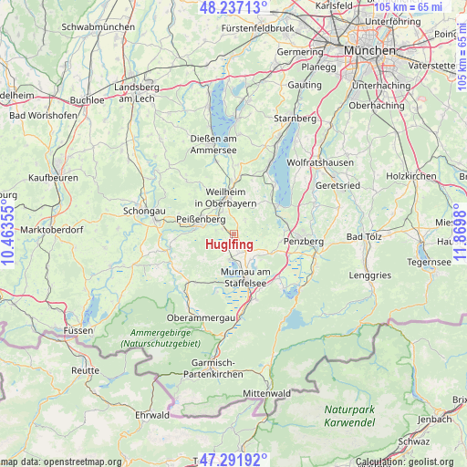
Huglfing GPS coordinates[2]
47° 46' 0.012" North, 11° 10' 0.012" East
| Map corner | latitude | longitude |
|---|---|---|
| Upper-left | 48.23713°, | 10.46355° |
| Center: | 47.76667°, | 11.16667° |
| Lower-right: | 47.29192°, | 11.8698° |
| Map W x H: | 105.1×105.1 km | = 65.3×65.3mi |
| max Lat: | 55.01917° ⇑98.1% North |
| Huglfing: | 47.76667° |
| min Lat: | ⇓1.9% South 47.40724° |
| min Long | Huglfing | max Long |
| 5.92978° | 11.16667° | 14.98853° |
| W 69.4%⇐ | ⇒30.6% E |
Elevation
Elevation of Huglfing is 632 m = 2073 ft, and this is 382.9 m = 1256 ft above average elevation for this country.
| Max E: |
1256 m = 4121 ft | 3.9% |
| Huglfing | 632 m 2073 ft | |
| Avg. | 249.1 m = 817 ft | |
Min E: |
-5 m = -16 ft | 96.1% |
See also: Germany elevation on elevation.city.
Geographical zone
Huglfing is located in North temperate zone (between Tropic of Cancer and the Arctic Circle). Distance of this North polar circle is 2090 km =1298.7 mi to North.| Distance of | km | miles | from Huglfing |
|---|---|---|---|
| North Pole | 4695.9 | 2917.9 | to North |
| Arctic Circle | 2090 | 1298.7 | to North |
| Tropic Cancer | 2705.2 | 1680.9 | to South |
| Equator | 5311.2 | 3300.2 | to South |


Nearby cities:
15 places around Huglfing: (largest is in red/bold)
• Antdorf
10.7 km =6.6 mi,  99°
99°
• Eglfing
3.9 km =2.4 mi,  161°
161°
• Habach
9.5 km =5.9 mi,  113°
113°
• Iffeldorf
11.2 km =7 mi,  90°
90°
• Murnau am Staffelsee
9.9 km =6.2 mi, 164°
• Oberhausen
3.1 km =1.9 mi,  306°
306°
• Obersöchering
5.3 km =3.3 mi,  134°
134°
• Peißenberg
8.4 km =5.2 mi,  300°
300°
• Polling
5.6 km =3.5 mi,  332°
332°
• Riegsee
9.1 km =5.7 mi,  146°
146°
• Seehausen am Staffelsee
8.7 km =5.4 mi,  170°
170°
• Seeshaupt
12 km =7.5 mi,  57°
57°
• Spatzenhausen
6.1 km =3.8 mi, 155°
• Uffing
6 km =3.7 mi,  191°
191°
• Weilheim
8.4 km =5.2 mi,  353°
353°
Sources, notices
• [Note1] Compared only with cities in Germany existing in our database
• [Src1] Map data: © OpenStreetMap contributors (CC-BY-SA)
• [Src2] Other city data from geonames.org with taken over terms of usage.
• [Src3] Geographical zone / Annual Mean Temperature by Robert A. Rohde @ Wikipedia
