Obersöchering geodata
Obersöchering (Bavaria) is a seat of a fourth-order administrative division; located in Germany in Europe/Berlin (GMT+2) time zone. With population of 1,454 people, there are 5973 cities with bigger population in this country. Compared to other cities in Germany, 98.5% of cities are located further ↑North; 70.2% of cities are located further ←West and 97% of cities have lower elevation than Obersöchering. Note1
Administrative division(s):
- Level 1: Bavaria
- Level 2: Upper Bavaria
- Level 3: Landkreis Weilheim-Schongau
- Level 4: Obersöchering


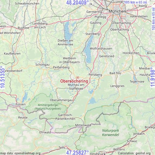
Obersöchering GPS coordinates[2]
47° 43' 59.988" North, 11° 13' 0.012" East
| Map corner | latitude | longitude |
|---|---|---|
| Upper-left | 48.20409°, | 10.51355° |
| Center: | 47.73333°, | 11.21667° |
| Lower-right: | 47.25827°, | 11.9198° |
| Map W x H: | 105.2×105.2 km | = 65.4×65.4mi |
| max Lat: | 55.01917° ⇑98.5% North |
| Obersöchering: | 47.73333° |
| min Lat: | ⇓1.5% South 47.40724° |
| min Long | Obersöchering | max Long |
| 5.92978° | 11.21667° | 14.98853° |
| W 70.2%⇐ | ⇒29.8% E |
Elevation
Elevation of Obersöchering is 662 m = 2172 ft, and this is 412.9 m = 1355 ft above average elevation for this country.
| Max E: |
1256 m = 4121 ft | 3% |
| Obersöchering | 662 m 2172 ft | |
| Avg. | 249.1 m = 817 ft | |
Min E: |
-5 m = -16 ft | 97% |
See also: Germany elevation on elevation.city.
Geographical zone
Obersöchering is located in North temperate zone (between Tropic of Cancer and the Arctic Circle). Distance of this North polar circle is 2093.7 km =1301 mi to North.| Distance of | km | miles | from Obersöchering |
|---|---|---|---|
| North Pole | 4699.6 | 2920.2 | to North |
| Arctic Circle | 2093.7 | 1301 | to North |
| Tropic Cancer | 2701.5 | 1678.6 | to South |
| Equator | 5307.4 | 3297.9 | to South |


Nearby cities:
15 places around Obersöchering: (largest is in red/bold)
• Antdorf
7.1 km =4.4 mi,  73°
73°
• Eglfing
2.5 km =1.6 mi,  270°
270°
• Großweil
9 km =5.6 mi,  135°
135°
• Habach
5 km =3.1 mi,  90°
90°
• Huglfing
5.3 km =3.3 mi,  314°
314°
• Iffeldorf
8.3 km =5.2 mi,  63°
63°
• Murnau am Staffelsee
5.9 km =3.7 mi,  191°
191°
• Oberhausen
8.3 km =5.2 mi, 311°
• Polling
10.7 km =6.6 mi,  323°
323°
• Riegsee
4.1 km =2.5 mi,  161°
161°
• Schlehdorf
11.2 km =7 mi, 138°
• Seehausen am Staffelsee
5.4 km =3.4 mi,  205°
205°
• Sindelsdorf
8.8 km =5.5 mi,  96°
96°
• Spatzenhausen
2.2 km =1.4 mi, 213°
• Uffing
5.4 km =3.4 mi,  246°
246°
Sources, notices
• [Note1] Compared only with cities in Germany existing in our database
• [Src1] Map data: © OpenStreetMap contributors (CC-BY-SA)
• [Src2] Other city data from geonames.org with taken over terms of usage.
• [Src3] Geographical zone / Annual Mean Temperature by Robert A. Rohde @ Wikipedia
