Peißenberg geodata
Peißenberg (Bavaria) is a populated place; located in Germany in Europe/Berlin (GMT+2) time zone. With population of 12,695 people, there are 1273 cities with bigger population in this country. Compared to other cities in Germany, 97.7% of cities are located further ↑North; 68% of cities are located further ←West and 94.3% of cities have lower elevation than Peißenberg. Note1
Administrative division(s):
- Level 1: Bavaria
- Level 2: Upper Bavaria
- Level 3: Landkreis Weilheim-Schongau
- Level 4: Peißenberg, Markt


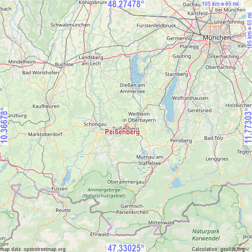
Peißenberg GPS coordinates[2]
47° 48' 16.776" North, 11° 4' 11.64" East
| Map corner | latitude | longitude |
|---|---|---|
| Upper-left | 48.27478°, | 10.36678° |
| Center: | 47.80466°, | 11.0699° |
| Lower-right: | 47.33025°, | 11.77303° |
| Map W x H: | 105×105 km | = 65.2×65.2mi |
| max Lat: | 55.01917° ⇑97.7% North |
| Peißenberg: | 47.80466° |
| min Lat: | ⇓2.3% South 47.40724° |
| min Long | Peißenberg | max Long |
| 5.92978° | 11.0699° | 14.98853° |
| W 68%⇐ | ⇒32% E |
Elevation
Elevation of Peißenberg is 582 m = 1909 ft, and this is 332.9 m = 1092 ft above average elevation for this country.
| Max E: |
1256 m = 4121 ft | 5.7% |
| Peißenberg | 582 m 1909 ft | |
| Avg. | 249.1 m = 817 ft | |
Min E: |
-5 m = -16 ft | 94.3% |
See also: Germany elevation on elevation.city.
Geographical zone
Peißenberg is located in North temperate zone (between Tropic of Cancer and the Arctic Circle). Distance of this North polar circle is 2085.8 km =1296.1 mi to North.| Distance of | km | miles | from Peißenberg |
|---|---|---|---|
| North Pole | 4691.7 | 2915.3 | to North |
| Arctic Circle | 2085.8 | 1296.1 | to North |
| Tropic Cancer | 2709.5 | 1683.6 | to South |
| Equator | 5315.4 | 3302.8 | to South |


Nearby cities:
15 places around Peißenberg: (largest is in red/bold)
• Böbing
8.2 km =5.1 mi,  228°
228°
• Eglfing
11.6 km =7.2 mi,  133°
133°
• Hohenpeißenberg
5.2 km =3.2 mi,  264°
264°
• Huglfing
8.4 km =5.2 mi,  120°
120°
• Oberhausen
5.3 km =3.3 mi, 116°
• Peiting
10.5 km =6.5 mi, 264°
• Polling
4.7 km =2.9 mi,  81°
81°
• Raisting
12.7 km =7.9 mi,  10°
10°
• Rott
13.3 km =8.3 mi,  326°
326°
• Rottenbuch
11.1 km =6.9 mi,  224°
224°
• Schongau
13 km =8.1 mi,  273°
273°
• Uffing
11.8 km =7.3 mi,  149°
149°
• Weilheim
7.5 km =4.7 mi,  57°
57°
• Wessobrunn
8.4 km =5.2 mi,  336°
336°
• Wielenbach
10.2 km =6.3 mi,  40°
40°
Sources, notices
• [Note1] Compared only with cities in Germany existing in our database
• [Src1] Map data: © OpenStreetMap contributors (CC-BY-SA)
• [Src2] Other city data from geonames.org with taken over terms of usage.
• [Src3] Geographical zone / Annual Mean Temperature by Robert A. Rohde @ Wikipedia
