Tuttlingen geodata
Tuttlingen (Baden-Württemberg) is a seat of a third-order administrative division; located in Germany in Europe/Berlin (GMT+2) time zone. With population of 34,847 people, there are 385 cities with bigger population in this country. Compared to other cities in Germany, 95.7% of cities are located further ↑North; 67.7% of cities are located further →East and 96.6% of cities have lower elevation than Tuttlingen. Note1
Administrative division(s):
- Level 1: Baden-Württemberg
- Level 2: Freiburg Region
- Level 3: Landkreis Tuttlingen
- Level 4: Tuttlingen


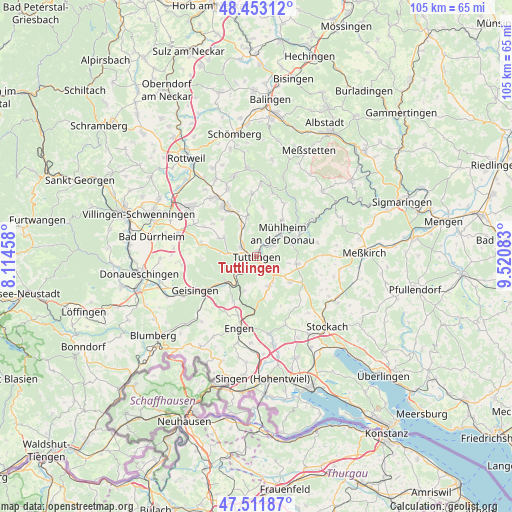
Tuttlingen GPS coordinates[2]
47° 59' 4.704" North, 8° 49' 3.72" East
| Map corner | latitude | longitude |
|---|---|---|
| Upper-left | 48.45312°, | 8.11458° |
| Center: | 47.98464°, | 8.8177° |
| Lower-right: | 47.51187°, | 9.52083° |
| Map W x H: | 104.7×104.7 km | = 65.1×65.1mi |
| max Lat: | 55.01917° ⇑95.7% North |
| Tuttlingen: | 47.98464° |
| min Lat: | ⇓4.3% South 47.40724° |
| min Long | Tuttlingen | max Long |
| 5.92978° | 8.8177° | 14.98853° |
| W 32.3%⇐ | ⇒67.7% E |
Elevation
Elevation of Tuttlingen is 646 m = 2119 ft, and this is 396.9 m = 1302 ft above average elevation for this country.
| Max E: |
1256 m = 4121 ft | 3.4% |
| Tuttlingen | 646 m 2119 ft | |
| Avg. | 249.1 m = 817 ft | |
Min E: |
-5 m = -16 ft | 96.6% |
See also: Germany elevation on elevation.city.
Geographical zone
Tuttlingen is located in North temperate zone (between Tropic of Cancer and the Arctic Circle). Distance of this North polar circle is 2065.8 km =1283.6 mi to North.| Distance of | km | miles | from Tuttlingen |
|---|---|---|---|
| North Pole | 4671.7 | 2902.9 | to North |
| Arctic Circle | 2065.8 | 1283.6 | to North |
| Tropic Cancer | 2729.5 | 1696 | to South |
| Equator | 5335.4 | 3315.3 | to South |


Nearby cities:
15 places around Tuttlingen: (largest is in red/bold)
• Balgheim
9.9 km =6.2 mi,  337°
337°
• Durchhausen
12.3 km =7.6 mi,  299°
299°
• Dürbheim
8.2 km =5.1 mi,  347°
347°
• Emmingen-Liptingen
7.5 km =4.7 mi,  139°
139°
• Fridingen an der Donau
8.8 km =5.5 mi,  63°
63°
• Gunningen
11.4 km =7.1 mi,  309°
309°
• Hausen ob Verena
10.3 km =6.4 mi,  317°
317°
• Immendingen
8.5 km =5.3 mi,  227°
227°
• Kolbingen
9.2 km =5.7 mi,  35°
35°
• Neuhausen ob Eck
8.3 km =5.2 mi,  99°
99°
• Rietheim-Weilheim
5.2 km =3.2 mi, 313°
• Seitingen-Oberflacht
8.3 km =5.2 mi, 295°
• Spaichingen
11.8 km =7.3 mi,  328°
328°
• Talheim
11.8 km =7.3 mi,  287°
287°
• Wurmlingen
3.1 km =1.9 mi, 303°
Sources, notices
• [Note1] Compared only with cities in Germany existing in our database
• [Src1] Map data: © OpenStreetMap contributors (CC-BY-SA)
• [Src2] Other city data from geonames.org with taken over terms of usage.
• [Src3] Geographical zone / Annual Mean Temperature by Robert A. Rohde @ Wikipedia
