Immendingen geodata
Immendingen (Baden-Württemberg) is a seat of a fourth-order administrative division; located in Germany in Europe/Berlin (GMT+2) time zone. With population of 5,945 people, there are 2480 cities with bigger population in this country. Compared to other cities in Germany, 96.3% of cities are located further ↑North; 68.7% of cities are located further →East and 96.9% of cities have lower elevation than Immendingen. Note1
Administrative division(s):
- Level 1: Baden-Württemberg
- Level 2: Freiburg Region
- Level 3: Landkreis Tuttlingen
- Level 4: Immendingen


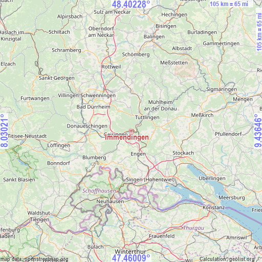
Immendingen GPS coordinates[2]
47° 55' 59.988" North, 8° 43' 59.988" East
| Map corner | latitude | longitude |
|---|---|---|
| Upper-left | 48.40228°, | 8.03021° |
| Center: | 47.93333°, | 8.73333° |
| Lower-right: | 47.46009°, | 9.43646° |
| Map W x H: | 104.8×104.8 km | = 65.1×65.1mi |
| max Lat: | 55.01917° ⇑96.3% North |
| Immendingen: | 47.93333° |
| min Lat: | ⇓3.7% South 47.40724° |
| min Long | Immendingen | max Long |
| 5.92978° | 8.73333° | 14.98853° |
| W 31.3%⇐ | ⇒68.7% E |
Elevation
Elevation of Immendingen is 660 m = 2165 ft, and this is 410.9 m = 1348 ft above average elevation for this country.
| Max E: |
1256 m = 4121 ft | 3.1% |
| Immendingen | 660 m 2165 ft | |
| Avg. | 249.1 m = 817 ft | |
Min E: |
-5 m = -16 ft | 96.9% |
See also: Germany elevation on elevation.city.
Geographical zone
Immendingen is located in North temperate zone (between Tropic of Cancer and the Arctic Circle). Distance of this North polar circle is 2071.5 km =1287.2 mi to North.| Distance of | km | miles | from Immendingen |
|---|---|---|---|
| North Pole | 4677.4 | 2906.4 | to North |
| Arctic Circle | 2071.5 | 1287.2 | to North |
| Tropic Cancer | 2723.8 | 1692.5 | to South |
| Equator | 5329.7 | 3311.7 | to South |


Nearby cities:
15 places around Immendingen: (largest is in red/bold)
• Aach
13.5 km =8.4 mi,  138°
138°
• Durchhausen
12.6 km =7.8 mi,  339°
339°
• Emmingen-Liptingen
11.2 km =7 mi,  90°
90°
• Engen
9.2 km =5.7 mi,  160°
160°
• Geisingen
6.3 km =3.9 mi,  261°
261°
• Gunningen
13.2 km =8.2 mi,  349°
349°
• Hausen
4.8 km =3 mi,  246°
246°
• Hausen ob Verena
13.4 km =8.3 mi,  357°
357°
• Neuhausen
11.1 km =6.9 mi, 163°
• Rietheim-Weilheim
9.6 km =6 mi,  14°
14°
• Seitingen-Oberflacht
9.3 km =5.8 mi, 352°
• Talheim
10.5 km =6.5 mi,  331°
331°
• Tengen
13.6 km =8.5 mi,  203°
203°
• Tuttlingen
8.5 km =5.3 mi,  47°
47°
• Wurmlingen
8.3 km =5.2 mi,  26°
26°
Sources, notices
• [Note1] Compared only with cities in Germany existing in our database
• [Src1] Map data: © OpenStreetMap contributors (CC-BY-SA)
• [Src2] Other city data from geonames.org with taken over terms of usage.
• [Src3] Geographical zone / Annual Mean Temperature by Robert A. Rohde @ Wikipedia
