Todtmoos geodata
Todtmoos (Baden-Württemberg) is a seat of a fourth-order administrative division; located in Germany in Europe/Berlin (GMT+2) time zone. With population of 2,215 people, there are 4786 cities with bigger population in this country. Compared to other cities in Germany, 98.3% of cities are located further ↑North; 77.1% of cities are located further →East and 99.3% of cities have lower elevation than Todtmoos. Note1
Administrative division(s):
- Level 1: Baden-Württemberg
- Level 2: Freiburg Region
- Level 3: Landkreis Waldshut
- Level 4: Todtmoos


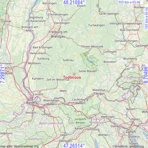
Todtmoos GPS coordinates[2]
47° 44' 24.504" North, 8° 0' 6.588" East
| Map corner | latitude | longitude |
|---|---|---|
| Upper-left | 48.21084°, | 7.29871° |
| Center: | 47.74014°, | 8.00183° |
| Lower-right: | 47.26514°, | 8.70496° |
| Map W x H: | 105.2×105.1 km | = 65.4×65.3mi |
| max Lat: | 55.01917° ⇑98.3% North |
| Todtmoos: | 47.74014° |
| min Lat: | ⇓1.7% South 47.40724° |
| min Long | Todtmoos | max Long |
| 5.92978° | 8.00183° | 14.98853° |
| W 22.9%⇐ | ⇒77.1% E |
Elevation
Elevation of Todtmoos is 809 m = 2654 ft, and this is 559.9 m = 1837 ft above average elevation for this country.
| Max E: |
1256 m = 4121 ft | 0.7% |
| Todtmoos | 809 m 2654 ft | |
| Avg. | 249.1 m = 817 ft | |
Min E: |
-5 m = -16 ft | 99.3% |
See also: Germany elevation on elevation.city.
Geographical zone
Todtmoos is located in North temperate zone (between Tropic of Cancer and the Arctic Circle). Distance of this North polar circle is 2093 km =1300.5 mi to North.| Distance of | km | miles | from Todtmoos |
|---|---|---|---|
| North Pole | 4698.9 | 2919.8 | to North |
| Arctic Circle | 2093 | 1300.5 | to North |
| Tropic Cancer | 2702.3 | 1679.1 | to South |
| Equator | 5308.2 | 3298.4 | to South |


Nearby cities:
15 places around Todtmoos: (largest is in red/bold)
• Aitern
10.1 km =6.3 mi,  311°
311°
• Bernau
7.2 km =4.5 mi,  22°
22°
• Dachsberg
7.4 km =4.6 mi,  99°
99°
• Görwihl
12.1 km =7.5 mi,  153°
153°
• Herrischried
8.2 km =5.1 mi,  180°
180°
• Höchenschwand
12.3 km =7.6 mi,  93°
93°
• Ibach
4.9 km =3 mi, 98°
• Sankt Blasien
9.7 km =6 mi,  75°
75°
• Schönau im Schwarzwald
9.5 km =5.9 mi,  302°
302°
• Schönenberg
10.7 km =6.6 mi, 303°
• Todtnau
10.8 km =6.7 mi,  336°
336°
• Tunau
7.7 km =4.8 mi, 311°
• Utzenfeld
9.2 km =5.7 mi,  316°
316°
• Wembach
9.3 km =5.8 mi,  292°
292°
• Zell im Wiesental
11.8 km =7.3 mi,  251°
251°
Sources, notices
• [Note1] Compared only with cities in Germany existing in our database
• [Src1] Map data: © OpenStreetMap contributors (CC-BY-SA)
• [Src2] Other city data from geonames.org with taken over terms of usage.
• [Src3] Geographical zone / Annual Mean Temperature by Robert A. Rohde @ Wikipedia
