Dachsberg geodata
Dachsberg (Baden-Württemberg) is a seat of a fourth-order administrative division; located in Germany in Europe/Berlin (GMT+2) time zone. In our database, there are 11009 cities with bigger population. Compared to other cities in Germany, 98.5% of cities are located further ↑North; 75.5% of cities are located further →East and 99.8% of cities have lower elevation than Dachsberg. Note1
Administrative division(s):
- Level 1: Baden-Württemberg
- Level 2: Freiburg Region
- Level 3: Landkreis Waldshut
- Level 4: Dachsberg


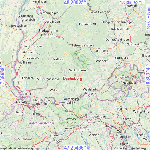
Dachsberg GPS coordinates[2]
47° 43' 46.02" North, 8° 6' 0.036" East
| Map corner | latitude | longitude |
|---|---|---|
| Upper-left | 48.20025°, | 7.39689° |
| Center: | 47.72945°, | 8.10001° |
| Lower-right: | 47.25436°, | 8.80314° |
| Map W x H: | 105.2×105.2 km | = 65.4×65.4mi |
| max Lat: | 55.01917° ⇑98.5% North |
| Dachsberg: | 47.72945° |
| min Lat: | ⇓1.5% South 47.40724° |
| min Long | Dachsberg | max Long |
| 5.92978° | 8.10001° | 14.98853° |
| W 24.5%⇐ | ⇒75.5% E |
Elevation
Elevation of Dachsberg is 912 m = 2992 ft, and this is 662.9 m = 2175 ft above average elevation for this country.
| Max E: |
1256 m = 4121 ft | 0.2% |
| Dachsberg | 912 m 2992 ft | |
| Avg. | 249.1 m = 817 ft | |
Min E: |
-5 m = -16 ft | 99.8% |
See also: Germany elevation on elevation.city.
Geographical zone
Dachsberg is located in North temperate zone (between Tropic of Cancer and the Arctic Circle). Distance of this North polar circle is 2094.2 km =1301.3 mi to North.| Distance of | km | miles | from Dachsberg |
|---|---|---|---|
| North Pole | 4700 | 2920.4 | to North |
| Arctic Circle | 2094.2 | 1301.3 | to North |
| Tropic Cancer | 2701.1 | 1678.4 | to South |
| Equator | 5307 | 3297.6 | to South |


Nearby cities:
15 places around Dachsberg: (largest is in red/bold)
• Bernau
9.1 km =5.7 mi,  329°
329°
• Dogern
14.3 km =8.9 mi,  159°
159°
• Grafenhausen
12.8 km =8 mi,  66°
66°
• Görwihl
9.8 km =6.1 mi,  191°
191°
• Herrischried
10.2 km =6.3 mi,  226°
226°
• Häusern
5.5 km =3.4 mi, 65°
• Höchenschwand
5 km =3.1 mi,  85°
85°
• Ibach
2.5 km =1.6 mi,  279°
279°
• Sankt Blasien
4.2 km =2.6 mi,  28°
28°
• Schluchsee
11.5 km =7.1 mi, 32°
• Staufen
8.8 km =5.5 mi, 69°
• Todtmoos
7.4 km =4.6 mi, 279°
• Tunau
14.6 km =9.1 mi,  295°
295°
• Waldshut-Tiengen
14.7 km =9.1 mi,  143°
143°
• Weilheim
12.2 km =7.6 mi,  124°
124°
Sources, notices
• [Note1] Compared only with cities in Germany existing in our database
• [Src1] Map data: © OpenStreetMap contributors (CC-BY-SA)
• [Src2] Other city data from geonames.org with taken over terms of usage.
• [Src3] Geographical zone / Annual Mean Temperature by Robert A. Rohde @ Wikipedia
