Teunz geodata
Teunz (Bavaria) is a seat of a fourth-order administrative division; located in Germany in Europe/Berlin (GMT+2) time zone. With population of 2,035 people, there are 5014 cities with bigger population in this country. Compared to other cities in Germany, 76% of cities are located further ↑North; 86.8% of cities are located further ←West and 85.1% of cities have lower elevation than Teunz. Note1
Administrative division(s):
- Level 1: Bavaria
- Level 2: Upper Palatinate
- Level 3: Landkreis Schwandorf
- Level 4: Teunz


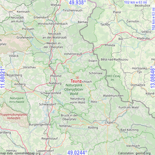
Teunz GPS coordinates[2]
49° 28' 59.988" North, 12° 22' 59.988" East
| Map corner | latitude | longitude |
|---|---|---|
| Upper-left | 49.938°, | 11.68021° |
| Center: | 49.48333°, | 12.38333° |
| Lower-right: | 49.0244°, | 13.08646° |
| Map W x H: | 101.6×101.6 km | = 63.1×63.1mi |
| max Lat: | 55.01917° ⇑76% North |
| Teunz: | 49.48333° |
| min Lat: | ⇓24% South 47.40724° |
| min Long | Teunz | max Long |
| 5.92978° | 12.38333° | 14.98853° |
| W 86.8%⇐ | ⇒13.2% E |
Elevation
Elevation of Teunz is 470 m = 1542 ft, and this is 220.9 m = 725 ft above average elevation for this country.
| Max E: |
1256 m = 4121 ft | 14.9% |
| Teunz | 470 m 1542 ft | |
| Avg. | 249.1 m = 817 ft | |
Min E: |
-5 m = -16 ft | 85.1% |
See also: Germany elevation on elevation.city.
Geographical zone
Teunz is located in North temperate zone (between Tropic of Cancer and the Arctic Circle). Distance of this North polar circle is 1899.1 km =1180 mi to North.| Distance of | km | miles | from Teunz |
|---|---|---|---|
| North Pole | 4505 | 2799.3 | to North |
| Arctic Circle | 1899.1 | 1180 | to North |
| Tropic Cancer | 2896.1 | 1799.6 | to South |
| Equator | 5502 | 3418.8 | to South |


Nearby cities:
15 places around Teunz: (largest is in red/bold)
• Altendorf
11.4 km =7.1 mi,  220°
220°
• Bach
9.3 km =5.8 mi,  180°
180°
• Dieterskirchen
7.8 km =4.8 mi,  161°
161°
• Gleiritsch
5.2 km =3.2 mi,  287°
287°
• Guteneck
8.1 km =5 mi,  242°
242°
• Moosbach
11.9 km =7.4 mi,  9°
9°
• Niedermurach
3.7 km =2.3 mi,  188°
188°
• Oberviechtach
3.7 km =2.3 mi,  139°
139°
• Schwarzhofen
12.1 km =7.5 mi, 193°
• Schönsee
12.2 km =7.6 mi,  75°
75°
• Thanstein
12.6 km =7.8 mi,  151°
151°
• Trausnitz
9.7 km =6 mi,  295°
295°
• Tännesberg
6.7 km =4.2 mi,  323°
323°
• Weiding
13.2 km =8.2 mi,  90°
90°
• Winklarn
9.4 km =5.8 mi,  131°
131°
Sources, notices
• [Note1] Compared only with cities in Germany existing in our database
• [Src1] Map data: © OpenStreetMap contributors (CC-BY-SA)
• [Src2] Other city data from geonames.org with taken over terms of usage.
• [Src3] Geographical zone / Annual Mean Temperature by Robert A. Rohde @ Wikipedia
