Winklarn geodata
Winklarn (Bavaria) is a populated place; located in Germany in Europe/Berlin (GMT+2) time zone. With population of 1,473 people, there are 5930 cities with bigger population in this country. Compared to other cities in Germany, 76.8% of cities are located further ↑North; 87.8% of cities are located further ←West and 90.7% of cities have lower elevation than Winklarn. Note1
Administrative division(s):
- Level 1: Bavaria
- Level 2: Upper Palatinate
- Level 3: Landkreis Schwandorf
- Level 4: Winklarn, Markt


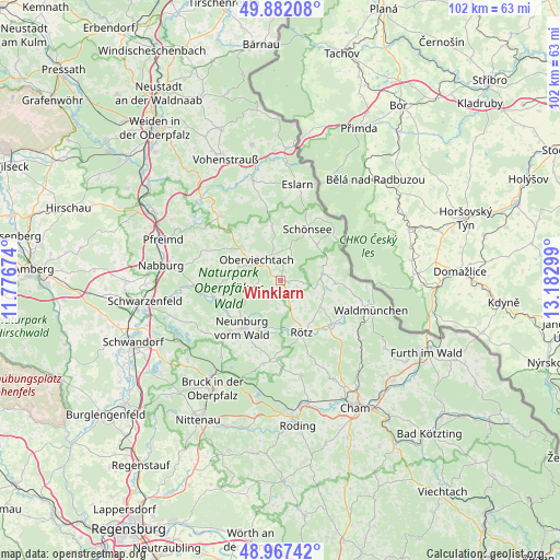
Winklarn GPS coordinates[2]
49° 25' 36.768" North, 12° 28' 47.496" East
| Map corner | latitude | longitude |
|---|---|---|
| Upper-left | 49.88208°, | 11.77674° |
| Center: | 49.42688°, | 12.47986° |
| Lower-right: | 48.96742°, | 13.18299° |
| Map W x H: | 101.7×101.7 km | = 63.2×63.2mi |
| max Lat: | 55.01917° ⇑76.8% North |
| Winklarn: | 49.42688° |
| min Lat: | ⇓23.2% South 47.40724° |
| min Long | Winklarn | max Long |
| 5.92978° | 12.47986° | 14.98853° |
| W 87.8%⇐ | ⇒12.2% E |
Elevation
Elevation of Winklarn is 523 m = 1716 ft, and this is 273.9 m = 899 ft above average elevation for this country.
| Max E: |
1256 m = 4121 ft | 9.3% |
| Winklarn | 523 m 1716 ft | |
| Avg. | 249.1 m = 817 ft | |
Min E: |
-5 m = -16 ft | 90.7% |
See also: Germany elevation on elevation.city.
Geographical zone
Winklarn is located in North temperate zone (between Tropic of Cancer and the Arctic Circle). Distance of this North polar circle is 1905.4 km =1184 mi to North.| Distance of | km | miles | from Winklarn |
|---|---|---|---|
| North Pole | 4511.3 | 2803.2 | to North |
| Arctic Circle | 1905.4 | 1184 | to North |
| Tropic Cancer | 2889.8 | 1795.6 | to South |
| Equator | 5495.8 | 3414.9 | to South |


Nearby cities:
15 places around Winklarn: (largest is in red/bold)
• Bach
7.6 km =4.7 mi,  246°
246°
• Dieterskirchen
4.7 km =2.9 mi,  256°
256°
• Neunburg vorm Wald
11.1 km =6.9 mi,  217°
217°
• Niedermurach
7.9 km =4.9 mi,  288°
288°
• Oberviechtach
5.7 km =3.5 mi,  307°
307°
• Pettendorf
11.9 km =7.4 mi,  227°
227°
• Rötz
10 km =6.2 mi,  158°
158°
• Schwarzhofen
11.2 km =7 mi,  240°
240°
• Schönsee
10.5 km =6.5 mi,  27°
27°
• Schönthal
12.2 km =7.6 mi,  134°
134°
• Teunz
9.4 km =5.8 mi, 311°
• Thanstein
4.9 km =3 mi,  191°
191°
• Tiefenbach
7.5 km =4.7 mi,  84°
84°
• Treffelstein
9.8 km =6.1 mi,  92°
92°
• Weiding
8.9 km =5.5 mi,  44°
44°
Sources, notices
• [Note1] Compared only with cities in Germany existing in our database
• [Src1] Map data: © OpenStreetMap contributors (CC-BY-SA)
• [Src2] Other city data from geonames.org with taken over terms of usage.
• [Src3] Geographical zone / Annual Mean Temperature by Robert A. Rohde @ Wikipedia
