Tettau geodata
Tettau (Bavaria) is a populated place; located in Germany in Europe/Berlin (GMT+2) time zone. With population of 2,516 people, there are 4419 cities with bigger population in this country. Compared to other cities in Germany, 53.4% of cities are located further ↑North; 70.8% of cities are located further ←West and 96.1% of cities have lower elevation than Tettau. Note1
Administrative division(s):
- Level 1: Bavaria
- Level 2: Upper Franconia
- Level 3: Landkreis Kronach
- Level 4: Tettau, Markt


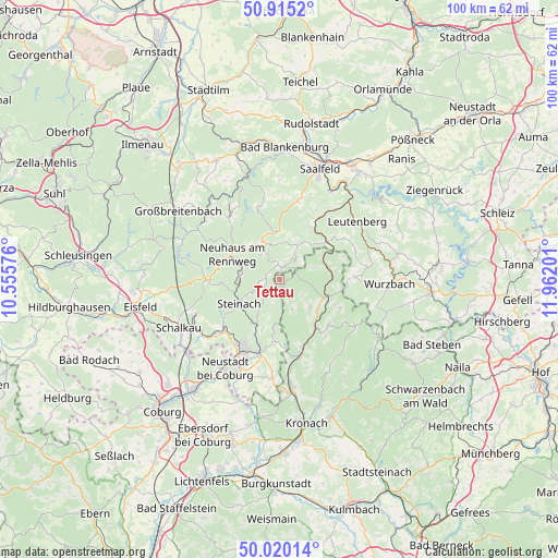
Tettau GPS coordinates[2]
50° 28' 11.244" North, 11° 15' 31.968" East
| Map corner | latitude | longitude |
|---|---|---|
| Upper-left | 50.9152°, | 10.55576° |
| Center: | 50.46979°, | 11.25888° |
| Lower-right: | 50.02014°, | 11.96201° |
| Map W x H: | 99.5×99.5 km | = 61.8×61.8mi |
| max Lat: | 55.01917° ⇑53.4% North |
| Tettau: | 50.46979° |
| min Lat: | ⇓46.6% South 47.40724° |
| min Long | Tettau | max Long |
| 5.92978° | 11.25888° | 14.98853° |
| W 70.8%⇐ | ⇒29.2% E |
Elevation
Elevation of Tettau is 632 m = 2073 ft, and this is 382.9 m = 1256 ft above average elevation for this country.
| Max E: |
1256 m = 4121 ft | 3.9% |
| Tettau | 632 m 2073 ft | |
| Avg. | 249.1 m = 817 ft | |
Min E: |
-5 m = -16 ft | 96.1% |
See also: Germany elevation on elevation.city.
Geographical zone
Tettau is located in North temperate zone (between Tropic of Cancer and the Arctic Circle). Distance of this North polar circle is 1789.5 km =1111.9 mi to North.| Distance of | km | miles | from Tettau |
|---|---|---|---|
| North Pole | 4395.3 | 2731.1 | to North |
| Arctic Circle | 1789.5 | 1111.9 | to North |
| Tropic Cancer | 3005.8 | 1867.7 | to South |
| Equator | 5611.7 | 3486.9 | to South |


Nearby cities:
15 places around Tettau: (largest is in red/bold)
• Judenbach
8.6 km =5.3 mi,  198°
198°
• Lauscha
7.1 km =4.4 mi,  276°
276°
• Lichte
7.5 km =4.7 mi,  314°
314°
• Ludwigsstadt
9.3 km =5.8 mi,  78°
78°
• Marktgölitz
11 km =6.8 mi,  29°
29°
• Mengersgereuth-Hämmern
12.9 km =8 mi,  231°
231°
• Neuhaus am Rennweg
9.7 km =6 mi,  297°
297°
• Piesau
6 km =3.7 mi,  330°
330°
• Probstzella
11.3 km =7 mi,  51°
51°
• Reichenbach
12 km =7.5 mi,  114°
114°
• Reichmannsdorf
8.9 km =5.5 mi,  359°
359°
• Schmiedefeld
7.7 km =4.8 mi,  337°
337°
• Steinach
8.3 km =5.2 mi,  238°
238°
• Steinheid
12.5 km =7.8 mi,  267°
267°
• Teuschnitz
11.8 km =7.3 mi,  132°
132°
Sources, notices
• [Note1] Compared only with cities in Germany existing in our database
• [Src1] Map data: © OpenStreetMap contributors (CC-BY-SA)
• [Src2] Other city data from geonames.org with taken over terms of usage.
• [Src3] Geographical zone / Annual Mean Temperature by Robert A. Rohde @ Wikipedia
