Tauberbischofsheim geodata
Tauberbischofsheim (Baden-Württemberg) is a seat of a third-order administrative division; located in Germany in Europe/Berlin (GMT+2) time zone. With population of 13,293 people, there are 1203 cities with bigger population in this country. Compared to other cities in Germany, 73.2% of cities are located further ↑North; 55.1% of cities are located further →East and 56.8% of cities have higher elevation than Tauberbischofsheim. Note1
Administrative division(s):
- Level 1: Baden-Württemberg
- Level 2: Regierungsbezirk Stuttgart
- Level 3: Main-Tauber-Kreis
- Level 4: Tauberbischofsheim


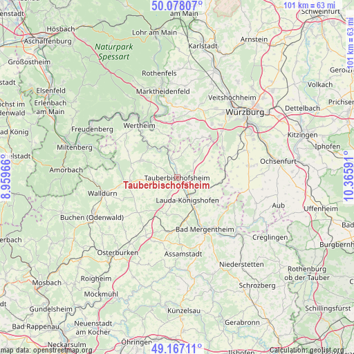
Tauberbischofsheim GPS coordinates[2]
49° 37' 28.992" North, 9° 39' 46.008" East
| Map corner | latitude | longitude |
|---|---|---|
| Upper-left | 50.07807°, | 8.95966° |
| Center: | 49.62472°, | 9.66278° |
| Lower-right: | 49.16711°, | 10.36591° |
| Map W x H: | 101.3×101.3 km | = 62.9×62.9mi |
| max Lat: | 55.01917° ⇑73.2% North |
| Tauberbischofsheim: | 49.62472° |
| min Lat: | ⇓26.8% South 47.40724° |
| min Long | Tauberbischofsh | max Long |
| 5.92978° | 9.66278° | 14.98853° |
| W 44.9%⇐ | ⇒55.1% E |
Elevation
Elevation of Tauberbischofsheim is 176 m = 577 ft, and this is 73.1 m = 240 ft below average elevation for this country.
| Max E: |
1256 m = 4121 ft | 56.8% |
| Avg. | 249.1 m = 817 ft | |
| Tauberbischofsheim | 176 m = 577 ft | |
Min E: |
-5 m = -16 ft | 43.2% |
See also: Germany elevation on elevation.city.
Geographical zone
Tauberbischofsheim is located in North temperate zone (between Tropic of Cancer and the Arctic Circle). Distance of this North polar circle is 1883.4 km =1170.3 mi to North.| Distance of | km | miles | from Tauberbischofsheim |
|---|---|---|---|
| North Pole | 4489.3 | 2789.5 | to North |
| Arctic Circle | 1883.4 | 1170.3 | to North |
| Tropic Cancer | 2911.8 | 1809.3 | to South |
| Equator | 5517.8 | 3428.6 | to South |


Nearby cities:
15 places around Tauberbischofsheim: (largest is in red/bold)
• Bad Mergentheim
16.7 km =10.4 mi,  151°
151°
• Boxberg
16.2 km =10.1 mi,  185°
185°
• Buch am Ahorn
12.3 km =7.6 mi,  219°
219°
• Bütthard
15.9 km =9.9 mi,  100°
100°
• Großrinderfeld
6.8 km =4.2 mi,  48°
48°
• Grünsfeld
6.3 km =3.9 mi,  105°
105°
• Hardheim
13.8 km =8.6 mi,  264°
264°
• Helmstadt
15.6 km =9.7 mi,  12°
12°
• Kirchheim
14.5 km =9 mi,  76°
76°
• Kleinrinderfeld
15.6 km =9.7 mi,  57°
57°
• Königheim
4.8 km =3 mi, 264°
• Külsheim
11.2 km =7 mi,  296°
296°
• Lauda-Königshofen
7.4 km =4.6 mi, 153°
• Neubrunn
11.8 km =7.3 mi,  3°
3°
• Werbach
5.4 km =3.4 mi,  341°
341°
Sources, notices
• [Note1] Compared only with cities in Germany existing in our database
• [Src1] Map data: © OpenStreetMap contributors (CC-BY-SA)
• [Src2] Other city data from geonames.org with taken over terms of usage.
• [Src3] Geographical zone / Annual Mean Temperature by Robert A. Rohde @ Wikipedia
