Buch am Ahorn geodata
Buch am Ahorn (Baden-Württemberg) is a populated place; located in Germany in Europe/Berlin (GMT+2) time zone. With population of 2,372 people, there are 4585 cities with bigger population in this country. Compared to other cities in Germany, 75% of cities are located further ↑North; 56.9% of cities are located further →East and 71.8% of cities have lower elevation than Buch am Ahorn. Note1
Administrative division(s):
- Level 1: Baden-Württemberg
- Level 2: Regierungsbezirk Stuttgart
- Level 3: Main-Tauber-Kreis
- Level 4: Ahorn


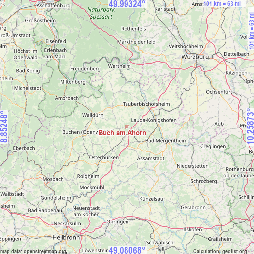
Buch am Ahorn GPS coordinates[2]
49° 32' 20.724" North, 9° 33' 20.16" East
| Map corner | latitude | longitude |
|---|---|---|
| Upper-left | 49.99324°, | 8.85248° |
| Center: | 49.53909°, | 9.5556° |
| Lower-right: | 49.08068°, | 10.25873° |
| Map W x H: | 101.5×101.5 km | = 63.1×63.1mi |
| max Lat: | 55.01917° ⇑75% North |
| Buch am Ahorn: | 49.53909° |
| min Lat: | ⇓25% South 47.40724° |
| min Long | Buch am Ahorn | max Long |
| 5.92978° | 9.5556° | 14.98853° |
| W 43.1%⇐ | ⇒56.9% E |
Elevation
Elevation of Buch am Ahorn is 373 m = 1224 ft, and this is 123.9 m = 406 ft above average elevation for this country.
| Max E: |
1256 m = 4121 ft | 28.2% |
| Buch am Ahorn | 373 m 1224 ft | |
| Avg. | 249.1 m = 817 ft | |
Min E: |
-5 m = -16 ft | 71.8% |
See also: Germany elevation on elevation.city.
Geographical zone
Buch am Ahorn is located in North temperate zone (between Tropic of Cancer and the Arctic Circle). Distance of this North polar circle is 1892.9 km =1176.2 mi to North.| Distance of | km | miles | from Buch am Ahorn |
|---|---|---|---|
| North Pole | 4498.8 | 2795.4 | to North |
| Arctic Circle | 1892.9 | 1176.2 | to North |
| Tropic Cancer | 2902.3 | 1803.4 | to South |
| Equator | 5508.2 | 3422.6 | to South |


Nearby cities:
15 places around Buch am Ahorn: (largest is in red/bold)
• Assamstadt
15.5 km =9.6 mi,  142°
142°
• Bad Mergentheim
16.6 km =10.3 mi,  108°
108°
• Boxberg
9 km =5.6 mi, 137°
• Buchen in Odenwald
16.9 km =10.5 mi,  264°
264°
• Grünsfeld
15.9 km =9.9 mi,  60°
60°
• Hardheim
10.1 km =6.3 mi,  323°
323°
• Höpfingen
11.6 km =7.2 mi,  307°
307°
• Königheim
9.5 km =5.9 mi,  17°
17°
• Külsheim
14.7 km =9.1 mi,  350°
350°
• Lauda-Königshofen
11.4 km =7.1 mi,  75°
75°
• Osterburken
15.5 km =9.6 mi,  218°
218°
• Rosenberg
11 km =6.8 mi,  212°
212°
• Tauberbischofsheim
12.3 km =7.6 mi,  39°
39°
• Walldürn
14.5 km =9 mi,  289°
289°
• Werbach
15.8 km =9.8 mi, 22°
Sources, notices
• [Note1] Compared only with cities in Germany existing in our database
• [Src1] Map data: © OpenStreetMap contributors (CC-BY-SA)
• [Src2] Other city data from geonames.org with taken over terms of usage.
• [Src3] Geographical zone / Annual Mean Temperature by Robert A. Rohde @ Wikipedia
