Lauda-Königshofen geodata
Lauda-Königshofen (Baden-Württemberg) is a populated place; located in Germany in Europe/Berlin (GMT+2) time zone. With population of 15,278 people, there are 1046 cities with bigger population in this country. Compared to other cities in Germany, 74.5% of cities are located further ↑North; 54.2% of cities are located further →East and 54.2% of cities have higher elevation than Lauda-Königshofen. Note1
Administrative division(s):
- Level 1: Baden-Württemberg
- Level 2: Regierungsbezirk Stuttgart
- Level 3: Main-Tauber-Kreis
- Level 4: Lauda-Königshofen


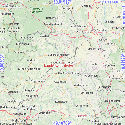
Lauda-Königshofen GPS coordinates[2]
49° 33' 54.936" North, 9° 42' 29.376" East
| Map corner | latitude | longitude |
|---|---|---|
| Upper-left | 50.01917°, | 9.00503° |
| Center: | 49.56526°, | 9.70816° |
| Lower-right: | 49.10709°, | 10.41129° |
| Map W x H: | 101.4×101.4 km | = 63×63mi |
| max Lat: | 55.01917° ⇑74.5% North |
| Lauda-Königshofen: | 49.56526° |
| min Lat: | ⇓25.5% South 47.40724° |
| min Long | Lauda-Königsho | max Long |
| 5.92978° | 9.70816° | 14.98853° |
| W 45.8%⇐ | ⇒54.2% E |
Elevation
Elevation of Lauda-Königshofen is 195 m = 640 ft, and this is 54.1 m = 177 ft below average elevation for this country.
| Max E: |
1256 m = 4121 ft | 54.2% |
| Avg. | 249.1 m = 817 ft | |
| Lauda-Königshofen | 195 m = 640 ft | |
Min E: |
-5 m = -16 ft | 45.8% |
See also: Germany elevation on elevation.city.
Geographical zone
Lauda-Königshofen is located in North temperate zone (between Tropic of Cancer and the Arctic Circle). Distance of this North polar circle is 1890 km =1174.4 mi to North.| Distance of | km | miles | from Lauda-Königshofen |
|---|---|---|---|
| North Pole | 4495.9 | 2793.6 | to North |
| Arctic Circle | 1890 | 1174.4 | to North |
| Tropic Cancer | 2905.2 | 1805.2 | to South |
| Equator | 5511.1 | 3424.4 | to South |


Nearby cities:
15 places around Lauda-Königshofen: (largest is in red/bold)
• Assamstadt
15.3 km =9.5 mi,  185°
185°
• Bad Mergentheim
9.4 km =5.8 mi,  149°
149°
• Boxberg
10.7 km =6.6 mi,  207°
207°
• Buch am Ahorn
11.4 km =7.1 mi,  255°
255°
• Bütthard
12.9 km =8 mi,  73°
73°
• Großrinderfeld
11.3 km =7 mi,  9°
9°
• Grünsfeld
5.7 km =3.5 mi,  29°
29°
• Igersheim
11.1 km =6.9 mi,  135°
135°
• Kirchheim
14.8 km =9.2 mi,  46°
46°
• Königheim
10.1 km =6.3 mi,  307°
307°
• Külsheim
17.6 km =10.9 mi, 311°
• Sulzdorf
17 km =10.6 mi,  56°
56°
• Tauberbischofsheim
7.4 km =4.6 mi,  333°
333°
• Weikersheim
16.9 km =10.5 mi,  124°
124°
• Werbach
12.7 km =7.9 mi,  337°
337°
Sources, notices
• [Note1] Compared only with cities in Germany existing in our database
• [Src1] Map data: © OpenStreetMap contributors (CC-BY-SA)
• [Src2] Other city data from geonames.org with taken over terms of usage.
• [Src3] Geographical zone / Annual Mean Temperature by Robert A. Rohde @ Wikipedia
