Sulzburg geodata
Sulzburg (Baden-Württemberg) is a populated place; located in Germany in Europe/Berlin (GMT+2) time zone. With population of 2,717 people, there are 4218 cities with bigger population in this country. Compared to other cities in Germany, 97.2% of cities are located further ↑North; 82.9% of cities are located further →East and 67.4% of cities have lower elevation than Sulzburg. Note1
Administrative division(s):
- Level 1: Baden-Württemberg
- Level 2: Freiburg Region
- Level 3: Landkreis Breisgau-Hochschwarzwald
- Level 4: Sulzburg


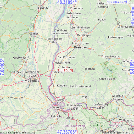
Sulzburg GPS coordinates[2]
47° 50' 28.176" North, 7° 42' 27.972" East
| Map corner | latitude | longitude |
|---|---|---|
| Upper-left | 48.31094°, | 7.00465° |
| Center: | 47.84116°, | 7.70777° |
| Lower-right: | 47.36708°, | 8.4109° |
| Map W x H: | 104.9×104.9 km | = 65.2×65.2mi |
| max Lat: | 55.01917° ⇑97.2% North |
| Sulzburg: | 47.84116° |
| min Lat: | ⇓2.8% South 47.40724° |
| min Long | Sulzburg | max Long |
| 5.92978° | 7.70777° | 14.98853° |
| W 17.1%⇐ | ⇒82.9% E |
Elevation
Elevation of Sulzburg is 338 m = 1109 ft, and this is 88.9 m = 292 ft above average elevation for this country.
| Max E: |
1256 m = 4121 ft | 32.6% |
| Sulzburg | 338 m 1109 ft | |
| Avg. | 249.1 m = 817 ft | |
Min E: |
-5 m = -16 ft | 67.4% |
See also: Germany elevation on elevation.city.
Geographical zone
Sulzburg is located in North temperate zone (between Tropic of Cancer and the Arctic Circle). Distance of this North polar circle is 2081.7 km =1293.5 mi to North.| Distance of | km | miles | from Sulzburg |
|---|---|---|---|
| North Pole | 4687.6 | 2912.7 | to North |
| Arctic Circle | 2081.7 | 1293.5 | to North |
| Tropic Cancer | 2713.5 | 1686.1 | to South |
| Equator | 5319.4 | 3305.3 | to South |


Nearby cities:
15 places around Sulzburg: (largest is in red/bold)
• Auggen
10.3 km =6.4 mi,  231°
231°
• Bad Krozingen
8.4 km =5.2 mi,  356°
356°
• Badenweiler
5.1 km =3.2 mi,  211°
211°
• Bollschweil
10.8 km =6.7 mi,  34°
34°
• Buggingen
5.3 km =3.3 mi,  277°
277°
• Böllen
11 km =6.8 mi,  114°
114°
• Eschbach
6.8 km =4.2 mi,  324°
324°
• Feldberg
8.9 km =5.5 mi, 213°
• Heitersheim
5.3 km =3.3 mi,  314°
314°
• Müllheim
6.8 km =4.2 mi,  237°
237°
• Münstertal/Schwarzwald
5.9 km =3.7 mi,  75°
75°
• Neuenburg am Rhein
11.4 km =7.1 mi,  254°
254°
• Pfaffenweiler
10.7 km =6.6 mi,  17°
17°
• Unterkrozingen
8.8 km =5.5 mi,  351°
351°
• Wies
11.3 km =7 mi,  156°
156°
Sources, notices
• [Note1] Compared only with cities in Germany existing in our database
• [Src1] Map data: © OpenStreetMap contributors (CC-BY-SA)
• [Src2] Other city data from geonames.org with taken over terms of usage.
• [Src3] Geographical zone / Annual Mean Temperature by Robert A. Rohde @ Wikipedia
