Stein-Neukirch geodata
Stein-Neukirch (Rheinland-Pfalz) is a seat of a fourth-order administrative division; located in Germany in Europe/Berlin (GMT+2) time zone. With population of 490 people, there are 9414 cities with bigger population in this country. Compared to other cities in Germany, 51.4% of cities are located further ↓South; 76.2% of cities are located further →East and 95.7% of cities have lower elevation than Stein-Neukirch. Note1
Administrative division(s):
- Level 1: Rheinland-Pfalz
- Level 3: Westerwaldkreis
- Level 4: Stein-Neukirch


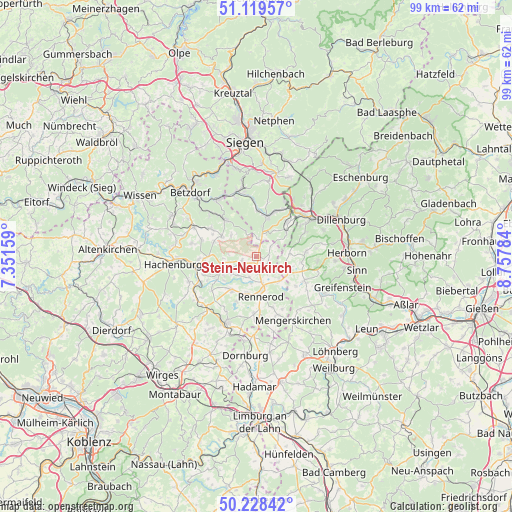
Stein-Neukirch GPS coordinates[2]
50° 40' 33.996" North, 8° 3' 16.992" East
| Map corner | latitude | longitude |
|---|---|---|
| Upper-left | 51.11957°, | 7.35159° |
| Center: | 50.67611°, | 8.05472° |
| Lower-right: | 50.22842°, | 8.75784° |
| Map W x H: | 99.1×99.1 km | = 61.6×61.6mi |
| max Lat: | 55.01917° ⇑48.6% North |
| Stein-Neukirch: | 50.67611° |
| min Lat: | ⇓51.4% South 47.40724° |
| min Long | Stein-Neukirch | max Long |
| 5.92978° | 8.05472° | 14.98853° |
| W 23.8%⇐ | ⇒76.2% E |
Elevation
Elevation of Stein-Neukirch is 615 m = 2018 ft, and this is 365.9 m = 1200 ft above average elevation for this country.
| Max E: |
1256 m = 4121 ft | 4.3% |
| Stein-Neukirch | 615 m 2018 ft | |
| Avg. | 249.1 m = 817 ft | |
Min E: |
-5 m = -16 ft | 95.7% |
See also: Germany elevation on elevation.city.
Geographical zone
Stein-Neukirch is located in North temperate zone (between Tropic of Cancer and the Arctic Circle). Distance of this North polar circle is 1766.5 km =1097.7 mi to North.| Distance of | km | miles | from Stein-Neukirch |
|---|---|---|---|
| North Pole | 4372.4 | 2716.9 | to North |
| Arctic Circle | 1766.5 | 1097.7 | to North |
| Tropic Cancer | 3028.7 | 1881.9 | to South |
| Equator | 5634.7 | 3501.2 | to South |


Nearby cities:
15 places around Stein-Neukirch: (largest is in red/bold)
• Bretthausen
1.3 km =0.8 mi,  141°
141°
• Emmerzhausen
3 km =1.9 mi,  331°
331°
• Fehl-Ritzhausen
5 km =3.1 mi,  226°
226°
• Hof
2.9 km =1.8 mi,  248°
248°
• Homberg
5.2 km =3.2 mi, 135°
• Liebenscheid
3.9 km =2.4 mi,  52°
52°
• Neustadt/Westerwald
5.3 km =3.3 mi,  191°
191°
• Niederroßbach
4.1 km =2.5 mi,  200°
200°
• Nisterberg
5.1 km =3.2 mi,  279°
279°
• Oberroßbach
2.6 km =1.6 mi, 203°
• Salzburg
1.1 km =0.7 mi, 197°
• Stockhausen-Illfurth
5.8 km =3.6 mi,  235°
235°
• Waigandshain
4.1 km =2.5 mi,  148°
148°
• Willingen
2.5 km =1.6 mi,  112°
112°
• Zehnhausen bei Rennerod
3.2 km =2 mi,  173°
173°
Sources, notices
• [Note1] Compared only with cities in Germany existing in our database
• [Src1] Map data: © OpenStreetMap contributors (CC-BY-SA)
• [Src2] Other city data from geonames.org with taken over terms of usage.
• [Src3] Geographical zone / Annual Mean Temperature by Robert A. Rohde @ Wikipedia
