Fehl-Ritzhausen geodata
Fehl-Ritzhausen (Rheinland-Pfalz) is a seat of a fourth-order administrative division; located in Germany in Europe/Berlin (GMT+2) time zone. With population of 862 people, there are 7654 cities with bigger population in this country. Compared to other cities in Germany, 50.6% of cities are located further ↓South; 77.1% of cities are located further →East and 89.9% of cities have lower elevation than Fehl-Ritzhausen. Note1
Administrative division(s):
- Level 1: Rheinland-Pfalz
- Level 3: Westerwaldkreis
- Level 4: Fehl-Ritzhausen


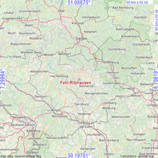
Fehl-Ritzhausen GPS coordinates[2]
50° 38' 42" North, 8° 0' 11.016" East
| Map corner | latitude | longitude |
|---|---|---|
| Upper-left | 51.08875°, | 7.29994° |
| Center: | 50.645°, | 8.00306° |
| Lower-right: | 50.19701°, | 8.70619° |
| Map W x H: | 99.2×99.2 km | = 61.6×61.6mi |
| max Lat: | 55.01917° ⇑49.4% North |
| Fehl-Ritzhausen: | 50.645° |
| min Lat: | ⇓50.6% South 47.40724° |
| min Long | Fehl-Ritzhausen | max Long |
| 5.92978° | 8.00306° | 14.98853° |
| W 22.9%⇐ | ⇒77.1% E |
Elevation
Elevation of Fehl-Ritzhausen is 513 m = 1683 ft, and this is 263.9 m = 866 ft above average elevation for this country.
| Max E: |
1256 m = 4121 ft | 10.1% |
| Fehl-Ritzhausen | 513 m 1683 ft | |
| Avg. | 249.1 m = 817 ft | |
Min E: |
-5 m = -16 ft | 89.9% |
See also: Germany elevation on elevation.city.
Geographical zone
Fehl-Ritzhausen is located in North temperate zone (between Tropic of Cancer and the Arctic Circle). Distance of this North polar circle is 1770 km =1099.8 mi to North.| Distance of | km | miles | from Fehl-Ritzhausen |
|---|---|---|---|
| North Pole | 4375.9 | 2719.1 | to North |
| Arctic Circle | 1770 | 1099.8 | to North |
| Tropic Cancer | 3025.3 | 1879.8 | to South |
| Equator | 5631.2 | 3499.1 | to South |


Nearby cities:
15 places around Fehl-Ritzhausen: (largest is in red/bold)
• Bad Marienberg
3.8 km =2.4 mi,  277°
277°
• Großseifen
2.9 km =1.8 mi,  243°
243°
• Hahn bei Marienberg
4.6 km =2.9 mi,  252°
252°
• Hellenhahn-Schellenberg
3.9 km =2.4 mi,  155°
155°
• Hof
2.6 km =1.6 mi,  21°
21°
• Höhn
3.4 km =2.1 mi,  203°
203°
• Langenbach bei Marienberg
4 km =2.5 mi,  258°
258°
• Lautzenbrücken
4.2 km =2.6 mi,  319°
319°
• Neustadt/Westerwald
3.1 km =1.9 mi,  123°
123°
• Niederroßbach
2.2 km =1.4 mi,  99°
99°
• Nisterberg
4.5 km =2.8 mi,  341°
341°
• Oberroßbach
2.8 km =1.7 mi,  67°
67°
• Salzburg
4.1 km =2.5 mi,  53°
53°
• Stockhausen-Illfurth
1.1 km =0.7 mi, 279°
• Zehnhausen bei Rennerod
4 km =2.5 mi,  86°
86°
Sources, notices
• [Note1] Compared only with cities in Germany existing in our database
• [Src1] Map data: © OpenStreetMap contributors (CC-BY-SA)
• [Src2] Other city data from geonames.org with taken over terms of usage.
• [Src3] Geographical zone / Annual Mean Temperature by Robert A. Rohde @ Wikipedia
