Neustadt/Westerwald geodata
Neustadt/Westerwald (Rheinland-Pfalz) is a seat of a fourth-order administrative division; located in Germany in Europe/Berlin (GMT+2) time zone. With population of 583 people, there are 8901 cities with bigger population in this country. Compared to other cities in Germany, 50.2% of cities are located further ↓South; 76.4% of cities are located further →East and 89.2% of cities have lower elevation than Neustadt/Westerwald. Note1
Administrative division(s):
- Level 1: Rheinland-Pfalz
- Level 3: Westerwaldkreis
- Level 4: Neustadt/ Westerwald


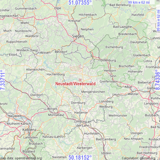
Neustadt/Westerwald GPS coordinates[2]
50° 37' 46.74" North, 8° 2' 24.828" East
| Map corner | latitude | longitude |
|---|---|---|
| Upper-left | 51.07355°, | 7.33711° |
| Center: | 50.62965°, | 8.04023° |
| Lower-right: | 50.18152°, | 8.74336° |
| Map W x H: | 99.2×99.2 km | = 61.6×61.6mi |
| max Lat: | 55.01917° ⇑49.8% North |
| Neustadt/Westerwald: | 50.62965° |
| min Lat: | ⇓50.2% South 47.40724° |
| min Long | Neustadt/Wester | max Long |
| 5.92978° | 8.04023° | 14.98853° |
| W 23.6%⇐ | ⇒76.4% E |
Elevation
Elevation of Neustadt/Westerwald is 505 m = 1657 ft, and this is 255.9 m = 840 ft above average elevation for this country.
| Max E: |
1256 m = 4121 ft | 10.8% |
| Neustadt/Westerwald | 505 m 1657 ft | |
| Avg. | 249.1 m = 817 ft | |
Min E: |
-5 m = -16 ft | 89.2% |
See also: Germany elevation on elevation.city.
Geographical zone
Neustadt/Westerwald is located in North temperate zone (between Tropic of Cancer and the Arctic Circle). Distance of this North polar circle is 1771.7 km =1100.9 mi to North.| Distance of | km | miles | from Neustadt/Westerwald |
|---|---|---|---|
| North Pole | 4377.6 | 2720.1 | to North |
| Arctic Circle | 1771.7 | 1100.9 | to North |
| Tropic Cancer | 3023.6 | 1878.8 | to South |
| Equator | 5629.5 | 3498 | to South |


Nearby cities:
15 places around Neustadt/Westerwald: (largest is in red/bold)
• Bretthausen
4.5 km =2.8 mi,  24°
24°
• Fehl-Ritzhausen
3.1 km =1.9 mi,  303°
303°
• Großseifen
5.2 km =3.2 mi,  274°
274°
• Hellenhahn-Schellenberg
2.1 km =1.3 mi,  207°
207°
• Hof
4.4 km =2.7 mi,  338°
338°
• Homberg
4.9 km =3 mi,  73°
73°
• Höhn
4.3 km =2.7 mi,  250°
250°
• Niederroßbach
1.4 km =0.9 mi, 343°
• Oberroßbach
2.8 km =1.7 mi,  359°
359°
• Pottum
4.4 km =2.7 mi,  220°
220°
• Rennerod
3 km =1.9 mi,  141°
141°
• Salzburg
4.2 km =2.6 mi,  9°
9°
• Stockhausen-Illfurth
4.2 km =2.6 mi, 296°
• Waigandshain
3.6 km =2.2 mi,  62°
62°
• Zehnhausen bei Rennerod
2.4 km =1.5 mi,  35°
35°
Sources, notices
• [Note1] Compared only with cities in Germany existing in our database
• [Src1] Map data: © OpenStreetMap contributors (CC-BY-SA)
• [Src2] Other city data from geonames.org with taken over terms of usage.
• [Src3] Geographical zone / Annual Mean Temperature by Robert A. Rohde @ Wikipedia
