Steinau geodata
Steinau (Lower Saxony) is a seat of a fourth-order administrative division; located in Germany in Europe/Berlin (GMT+2) time zone. In our database, there are 11009 cities with bigger population. Compared to other cities in Germany, 88.3% of cities are located further ↓South; 66.9% of cities are located further →East and 99.9% of cities have higher elevation than Steinau. Note1


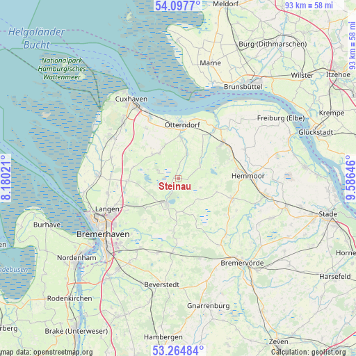
Steinau GPS coordinates[2]
53° 40' 59.988" North, 8° 52' 59.988" East
| Map corner | latitude | longitude |
|---|---|---|
| Upper-left | 54.0977°, | 8.18021° |
| Center: | 53.68333°, | 8.88333° |
| Lower-right: | 53.26484°, | 9.58646° |
| Map W x H: | 92.6×92.6 km | = 57.5×57.5mi |
| max Lat: | 55.01917° ⇑11.7% North |
| Steinau: | 53.68333° |
| min Lat: | ⇓88.3% South 47.40724° |
| min Long | Steinau | max Long |
| 5.92978° | 8.88333° | 14.98853° |
| W 33.1%⇐ | ⇒66.9% E |
Elevation
Elevation of Steinau is -3 m = -10 ft, and this is 252.1 m = 827 ft below average elevation for this country.
| Max E: |
1256 m = 4121 ft | 99.9% |
| Avg. | 249.1 m = 817 ft | |
| Steinau | -3 m = -10 ft | |
Min E: |
-5 m = -16 ft | 0.1% |
See also: Germany elevation on elevation.city.
Geographical zone
Steinau is located in North temperate zone (between Tropic of Cancer and the Arctic Circle). Distance of this North polar circle is 1432.1 km =889.9 mi to North.| Distance of | km | miles | from Steinau |
|---|---|---|---|
| North Pole | 4038 | 2509.1 | to North |
| Arctic Circle | 1432.1 | 889.9 | to North |
| Tropic Cancer | 3363.1 | 2089.7 | to South |
| Equator | 5969 | 3709 | to South |


Nearby cities:
15 places around Steinau: (largest is in red/bold)
• Bülkau
9.4 km =5.8 mi,  41°
41°
• Drangstedt
11.4 km =7.1 mi,  227°
227°
• Flögeln
5.7 km =3.5 mi,  244°
244°
• Ihlienworth
6 km =3.7 mi,  21°
21°
• Kührstedt
13 km =8.1 mi,  204°
204°
• Lintig
8.9 km =5.5 mi,  181°
181°
• Mittelstenahe
10.6 km =6.6 mi,  110°
110°
• Neuenkirchen
10.4 km =6.5 mi,  3°
3°
• Nordleda
9.8 km =6.1 mi,  340°
340°
• Odisheim
4.1 km =2.5 mi,  70°
70°
• Osterbruch
11.2 km =7 mi, 19°
• Otterndorf
14 km =8.7 mi, 4°
• Ringstedt
13.8 km =8.6 mi,  189°
189°
• Stinstedt
6.4 km =4 mi, 112°
• Wanna
9.2 km =5.7 mi,  323°
323°
Sources, notices
• [Note1] Compared only with cities in Germany existing in our database
• [Src1] Map data: © OpenStreetMap contributors (CC-BY-SA)
• [Src2] Other city data from geonames.org with taken over terms of usage.
• [Src3] Geographical zone / Annual Mean Temperature by Robert A. Rohde @ Wikipedia
