Stinstedt geodata
Stinstedt (Lower Saxony) is a seat of a fourth-order administrative division; located in Germany in Europe/Berlin (GMT+2) time zone. In our database, there are 11009 cities with bigger population. Compared to other cities in Germany, 87.9% of cities are located further ↓South; 65.8% of cities are located further →East and 94.3% of cities have higher elevation than Stinstedt. Note1


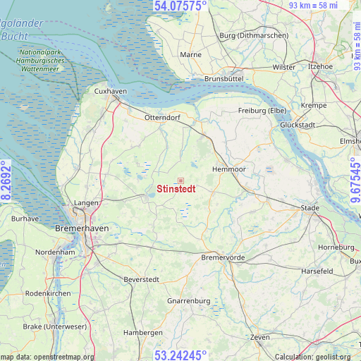
Stinstedt GPS coordinates[2]
53° 39' 40.176" North, 8° 58' 20.352" East
| Map corner | latitude | longitude |
|---|---|---|
| Upper-left | 54.07575°, | 8.2692° |
| Center: | 53.66116°, | 8.97232° |
| Lower-right: | 53.24245°, | 9.67545° |
| Map W x H: | 92.7×92.7 km | = 57.6×57.6mi |
| max Lat: | 55.01917° ⇑12.1% North |
| Stinstedt: | 53.66116° |
| min Lat: | ⇓87.9% South 47.40724° |
| min Long | Stinstedt | max Long |
| 5.92978° | 8.97232° | 14.98853° |
| W 34.2%⇐ | ⇒65.8% E |
Elevation
Elevation of Stinstedt is 10 m = 33 ft, and this is 239.1 m = 784 ft below average elevation for this country.
| Max E: |
1256 m = 4121 ft | 94.3% |
| Avg. | 249.1 m = 817 ft | |
| Stinstedt | 10 m = 33 ft | |
Min E: |
-5 m = -16 ft | 5.7% |
See also: Germany elevation on elevation.city.
Geographical zone
Stinstedt is located in North temperate zone (between Tropic of Cancer and the Arctic Circle). Distance of this North polar circle is 1434.6 km =891.4 mi to North.| Distance of | km | miles | from Stinstedt |
|---|---|---|---|
| North Pole | 4040.5 | 2510.6 | to North |
| Arctic Circle | 1434.6 | 891.4 | to North |
| Tropic Cancer | 3360.6 | 2088.2 | to South |
| Equator | 5966.6 | 3707.5 | to South |


Nearby cities:
15 places around Stinstedt: (largest is in red/bold)
• Alfstedt
13.8 km =8.6 mi,  153°
153°
• Armstorf
9.2 km =5.7 mi,  137°
137°
• Bülkau
9.5 km =5.9 mi,  2°
2°
• Cadenberge
13.4 km =8.3 mi,  26°
26°
• Flögeln
11 km =6.8 mi,  270°
270°
• Hemmoor
12.4 km =7.7 mi,  76°
76°
• Hollnseth
12.1 km =7.5 mi, 135°
• Ihlienworth
8.8 km =5.5 mi,  335°
335°
• Lamstedt
9 km =5.6 mi,  110°
110°
• Lintig
8.9 km =5.5 mi,  223°
223°
• Mittelstenahe
4.2 km =2.6 mi, 107°
• Odisheim
4.3 km =2.7 mi,  333°
333°
• Osterbruch
13.2 km =8.2 mi,  351°
351°
• Steinau
6.4 km =4 mi,  292°
292°
• Wingst
10.9 km =6.8 mi,  40°
40°
Sources, notices
• [Note1] Compared only with cities in Germany existing in our database
• [Src1] Map data: © OpenStreetMap contributors (CC-BY-SA)
• [Src2] Other city data from geonames.org with taken over terms of usage.
• [Src3] Geographical zone / Annual Mean Temperature by Robert A. Rohde @ Wikipedia
