Splietsdorf geodata
Splietsdorf (Mecklenburg-Vorpommern) is a populated place; located in Germany in Europe/Berlin (GMT+2) time zone. With population of 598 people, there are 8837 cities with bigger population in this country. Compared to other cities in Germany, 94.2% of cities are located further ↓South; 91.7% of cities are located further ←West and 91.6% of cities have higher elevation than Splietsdorf. Note1
Administrative division(s):
- Level 1: Mecklenburg-Vorpommern
- Level 3: Vorpommern-Rügen
- Level 4: Splietsdorf


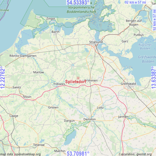
Splietsdorf GPS coordinates[2]
54° 7' 26.112" North, 12° 55' 50.664" East
| Map corner | latitude | longitude |
|---|---|---|
| Upper-left | 54.53393°, | 12.22762° |
| Center: | 54.12392°, | 12.93074° |
| Lower-right: | 53.70981°, | 13.63387° |
| Map W x H: | 91.6×91.6 km | = 56.9×56.9mi |
| max Lat: | 55.01917° ⇑5.8% North |
| Splietsdorf: | 54.12392° |
| min Lat: | ⇓94.2% South 47.40724° |
| min Long | Splietsdorf | max Long |
| 5.92978° | 12.93074° | 14.98853° |
| W 91.7%⇐ | ⇒8.3% E |
Elevation
Elevation of Splietsdorf is 17 m = 56 ft, and this is 232.1 m = 761 ft below average elevation for this country.
| Max E: |
1256 m = 4121 ft | 91.6% |
| Avg. | 249.1 m = 817 ft | |
| Splietsdorf | 17 m = 56 ft | |
Min E: |
-5 m = -16 ft | 8.4% |
See also: Germany elevation on elevation.city.
Geographical zone
Splietsdorf is located in North temperate zone (between Tropic of Cancer and the Arctic Circle). Distance of this North polar circle is 1383.2 km =859.5 mi to North.| Distance of | km | miles | from Splietsdorf |
|---|---|---|---|
| North Pole | 3989 | 2478.6 | to North |
| Arctic Circle | 1383.2 | 859.5 | to North |
| Tropic Cancer | 3412.1 | 2120.2 | to South |
| Equator | 6018 | 3739.4 | to South |


Nearby cities:
15 places around Splietsdorf: (largest is in red/bold)
• Deyelsdorf
11.3 km =7 mi,  218°
218°
• Eixen
14.1 km =8.8 mi,  287°
287°
• Elmenhorst
13.7 km =8.5 mi,  43°
43°
• Franzburg
7.5 km =4.7 mi,  335°
335°
• Glewitz
11.5 km =7.1 mi,  182°
182°
• Grammendorf
10.5 km =6.5 mi,  200°
200°
• Gransebieth
7.3 km =4.5 mi,  205°
205°
• Grimmen
7.3 km =4.5 mi,  100°
100°
• Jakobsdorf
12.1 km =7.5 mi,  0°
0°
• Richtenberg
8.9 km =5.5 mi, 344°
• Steinhagen
12 km =7.5 mi,  18°
18°
• Stoltenhagen
10.3 km =6.4 mi,  68°
68°
• Tribsees
11.8 km =7.3 mi,  254°
254°
• Wendisch Baggendorf
5.6 km =3.5 mi,  171°
171°
• Wittenhagen
11.3 km =7 mi,  53°
53°
Sources, notices
• [Note1] Compared only with cities in Germany existing in our database
• [Src1] Map data: © OpenStreetMap contributors (CC-BY-SA)
• [Src2] Other city data from geonames.org with taken over terms of usage.
• [Src3] Geographical zone / Annual Mean Temperature by Robert A. Rohde @ Wikipedia
