Grammendorf geodata
Grammendorf (Mecklenburg-Vorpommern) is a populated place; located in Germany in Europe/Berlin (GMT+2) time zone. With population of 670 people, there are 8474 cities with bigger population in this country. Compared to other cities in Germany, 93.1% of cities are located further ↓South; 91.3% of cities are located further ←West and 94.8% of cities have higher elevation than Grammendorf. Note1
Administrative division(s):
- Level 1: Mecklenburg-Vorpommern
- Level 3: Vorpommern-Rügen
- Level 4: Grammendorf


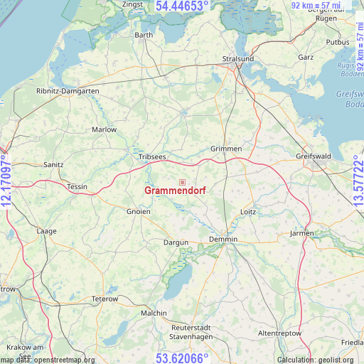
Grammendorf GPS coordinates[2]
54° 2' 8.34" North, 12° 52' 26.724" East
| Map corner | latitude | longitude |
|---|---|---|
| Upper-left | 54.44653°, | 12.17097° |
| Center: | 54.03565°, | 12.87409° |
| Lower-right: | 53.62066°, | 13.57722° |
| Map W x H: | 91.8×91.8 km | = 57×57mi |
| max Lat: | 55.01917° ⇑6.9% North |
| Grammendorf: | 54.03565° |
| min Lat: | ⇓93.1% South 47.40724° |
| min Long | Grammendorf | max Long |
| 5.92978° | 12.87409° | 14.98853° |
| W 91.3%⇐ | ⇒8.7% E |
Elevation
Elevation of Grammendorf is 9 m = 30 ft, and this is 240.1 m = 788 ft below average elevation for this country.
| Max E: |
1256 m = 4121 ft | 94.8% |
| Avg. | 249.1 m = 817 ft | |
| Grammendorf | 9 m = 30 ft | |
Min E: |
-5 m = -16 ft | 5.2% |
See also: Germany elevation on elevation.city.
Geographical zone
Grammendorf is located in North temperate zone (between Tropic of Cancer and the Arctic Circle). Distance of this North polar circle is 1393 km =865.6 mi to North.| Distance of | km | miles | from Grammendorf |
|---|---|---|---|
| North Pole | 3998.9 | 2484.8 | to North |
| Arctic Circle | 1393 | 865.6 | to North |
| Tropic Cancer | 3402.3 | 2114.1 | to South |
| Equator | 6008.2 | 3733.3 | to South |


Nearby cities:
15 places around Grammendorf: (largest is in red/bold)
• Bad Sülze
16.2 km =10.1 mi,  300°
300°
• Behren-Lübchin
13.7 km =8.5 mi,  266°
266°
• Dargun
15.1 km =9.4 mi,  185°
185°
• Deyelsdorf
3.5 km =2.2 mi,  285°
285°
• Düvier
12.9 km =8 mi,  100°
100°
• Glewitz
3.7 km =2.3 mi,  117°
117°
• Gnoien
13 km =8.1 mi,  235°
235°
• Gransebieth
3.3 km =2.1 mi,  9°
9°
• Grimmen
13.8 km =8.6 mi,  51°
51°
• Nossendorf
9.9 km =6.2 mi,  145°
145°
• Splietsdorf
10.5 km =6.5 mi,  20°
20°
• Stubbendorf
10.3 km =6.4 mi,  202°
202°
• Tribsees
10.1 km =6.3 mi,  311°
311°
• Wendisch Baggendorf
6.2 km =3.9 mi, 46°
• Zarnekow
15 km =9.3 mi,  174°
174°
Sources, notices
• [Note1] Compared only with cities in Germany existing in our database
• [Src1] Map data: © OpenStreetMap contributors (CC-BY-SA)
• [Src2] Other city data from geonames.org with taken over terms of usage.
• [Src3] Geographical zone / Annual Mean Temperature by Robert A. Rohde @ Wikipedia
