Sinzig geodata
Sinzig (Rheinland-Pfalz) is a populated place; located in Germany in Europe/Berlin (GMT+2) time zone. With population of 17,880 people, there are 888 cities with bigger population in this country. Compared to other cities in Germany, 51.8% of cities are located further ↑North; 90.8% of cities are located further →East and 72% of cities have higher elevation than Sinzig. Note1


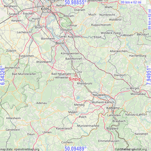
Sinzig GPS coordinates[2]
50° 32' 37.824" North, 7° 14' 47.004" East
| Map corner | latitude | longitude |
|---|---|---|
| Upper-left | 50.98855°, | 6.54326° |
| Center: | 50.54384°, | 7.24639° |
| Lower-right: | 50.09489°, | 7.94951° |
| Map W x H: | 99.4×99.4 km | = 61.8×61.8mi |
| max Lat: | 55.01917° ⇑51.8% North |
| Sinzig: | 50.54384° |
| min Lat: | ⇓48.2% South 47.40724° |
| min Long | Sinzig | max Long |
| 5.92978° | 7.24639° | 14.98853° |
| W 9.2%⇐ | ⇒90.8% E |
Elevation
Elevation of Sinzig is 78 m = 256 ft, and this is 171.1 m = 561 ft below average elevation for this country.
| Max E: |
1256 m = 4121 ft | 72% |
| Avg. | 249.1 m = 817 ft | |
| Sinzig | 78 m = 256 ft | |
Min E: |
-5 m = -16 ft | 28% |
See also: Germany elevation on elevation.city.
Geographical zone
Sinzig is located in North temperate zone (between Tropic of Cancer and the Arctic Circle). Distance of this North polar circle is 1781.2 km =1106.8 mi to North.| Distance of | km | miles | from Sinzig |
|---|---|---|---|
| North Pole | 4387.1 | 2726 | to North |
| Arctic Circle | 1781.2 | 1106.8 | to North |
| Tropic Cancer | 3014 | 1872.8 | to South |
| Equator | 5619.9 | 3492 | to South |


Nearby cities:
15 places around Sinzig: (largest is in red/bold)
• Bad Breisig
5.2 km =3.2 mi,  145°
145°
• Bad Hönningen
5.5 km =3.4 mi,  122°
122°
• Bruchhausen
6.2 km =3.9 mi,  2°
2°
• Dattenberg
3.5 km =2.2 mi,  72°
72°
• Erpel
4.5 km =2.8 mi,  348°
348°
• Gönnersdorf
6.9 km =4.3 mi,  167°
167°
• Kasbach-Ohlenberg
4.6 km =2.9 mi,  18°
18°
• Königsfeld
7.1 km =4.4 mi,  223°
223°
• Leubsdorf
3.8 km =2.4 mi,  79°
79°
• Linz am Rhein
3.9 km =2.4 mi,  44°
44°
• Ockenfels
4.1 km =2.5 mi,  29°
29°
• Remagen
4.1 km =2.5 mi,  340°
340°
• Rheinbrohl
7.8 km =4.8 mi,  128°
128°
• Unkel
6.2 km =3.9 mi, 341°
• Waldorf
6.8 km =4.2 mi,  187°
187°
Sources, notices
• [Note1] Compared only with cities in Germany existing in our database
• [Src1] Map data: © OpenStreetMap contributors (CC-BY-SA)
• [Src2] Other city data from geonames.org with taken over terms of usage.
• [Src3] Geographical zone / Annual Mean Temperature by Robert A. Rohde @ Wikipedia
