Seedorf geodata
Seedorf (Schleswig-Holstein) is a seat of a fourth-order administrative division; located in Germany in Europe/Berlin (GMT+2) time zone. With population of 541 people, there are 9136 cities with bigger population in this country. Compared to other cities in Germany, 87.3% of cities are located further ↓South; 65% of cities are located further ←West and 83.7% of cities have higher elevation than Seedorf. Note1
Administrative division(s):
- Level 1: Schleswig-Holstein
- Level 3: Kreis Herzogtum Lauenburg
- Level 4: Seedorf


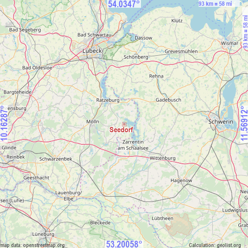
Seedorf GPS coordinates[2]
53° 37' 10.92" North, 10° 51' 57.564" East
| Map corner | latitude | longitude |
|---|---|---|
| Upper-left | 54.0347°, | 10.16287° |
| Center: | 53.6197°, | 10.86599° |
| Lower-right: | 53.20058°, | 11.56912° |
| Map W x H: | 92.7×92.7 km | = 57.6×57.6mi |
| max Lat: | 55.01917° ⇑12.7% North |
| Seedorf: | 53.6197° |
| min Lat: | ⇓87.3% South 47.40724° |
| min Long | Seedorf | max Long |
| 5.92978° | 10.86599° | 14.98853° |
| W 65%⇐ | ⇒35% E |
Elevation
Elevation of Seedorf is 38 m = 125 ft, and this is 211.1 m = 693 ft below average elevation for this country.
| Max E: |
1256 m = 4121 ft | 83.7% |
| Avg. | 249.1 m = 817 ft | |
| Seedorf | 38 m = 125 ft | |
Min E: |
-5 m = -16 ft | 16.3% |
See also: Germany elevation on elevation.city.
Geographical zone
Seedorf is located in North temperate zone (between Tropic of Cancer and the Arctic Circle). Distance of this North polar circle is 1439.2 km =894.3 mi to North.| Distance of | km | miles | from Seedorf |
|---|---|---|---|
| North Pole | 4045.1 | 2513.5 | to North |
| Arctic Circle | 1439.2 | 894.3 | to North |
| Tropic Cancer | 3356 | 2085.3 | to South |
| Equator | 5962 | 3704.6 | to South |


Nearby cities:
15 places around Seedorf: (largest is in red/bold)
• Brunsmark
8.8 km =5.5 mi,  267°
267°
• Fredeburg
11.1 km =6.9 mi,  297°
297°
• Gudow
9.5 km =5.9 mi,  221°
221°
• Hollenbek
4.4 km =2.7 mi, 223°
• Kittlitz
6 km =3.7 mi,  34°
34°
• Klein Zecher
4 km =2.5 mi,  179°
179°
• Lehmrade
8.2 km =5.1 mi,  249°
249°
• Mechow
11.6 km =7.2 mi,  338°
338°
• Mustin
7.2 km =4.5 mi,  9°
9°
• Ratzeburg
10.8 km =6.7 mi,  325°
325°
• Salem
4.8 km =3 mi, 327°
• Schmilau
8.6 km =5.3 mi, 303°
• Sterley
3.3 km =2.1 mi,  264°
264°
• Zarrentin
8.3 km =5.2 mi,  156°
156°
• Ziethen
9.1 km =5.7 mi, 335°
Sources, notices
• [Note1] Compared only with cities in Germany existing in our database
• [Src1] Map data: © OpenStreetMap contributors (CC-BY-SA)
• [Src2] Other city data from geonames.org with taken over terms of usage.
• [Src3] Geographical zone / Annual Mean Temperature by Robert A. Rohde @ Wikipedia
