Salem geodata
Salem (Schleswig-Holstein) is a seat of a fourth-order administrative division; located in Germany in Europe/Berlin (GMT+2) time zone. With population of 561 people, there are 9021 cities with bigger population in this country. Compared to other cities in Germany, 87.8% of cities are located further ↓South; 64.5% of cities are located further ←West and 82.3% of cities have higher elevation than Salem. Note1
Administrative division(s):
- Level 1: Schleswig-Holstein
- Level 3: Kreis Herzogtum Lauenburg
- Level 4: Salem


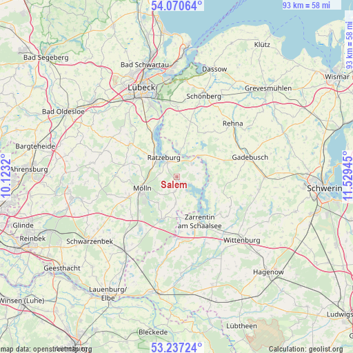
Salem GPS coordinates[2]
53° 39' 21.6" North, 10° 49' 34.752" East
| Map corner | latitude | longitude |
|---|---|---|
| Upper-left | 54.07064°, | 10.1232° |
| Center: | 53.656°, | 10.82632° |
| Lower-right: | 53.23724°, | 11.52945° |
| Map W x H: | 92.7×92.7 km | = 57.6×57.6mi |
| max Lat: | 55.01917° ⇑12.2% North |
| Salem: | 53.656° |
| min Lat: | ⇓87.8% South 47.40724° |
| min Long | Salem | max Long |
| 5.92978° | 10.82632° | 14.98853° |
| W 64.5%⇐ | ⇒35.5% E |
Elevation
Elevation of Salem is 41 m = 135 ft, and this is 208.1 m = 683 ft below average elevation for this country.
| Max E: |
1256 m = 4121 ft | 82.3% |
| Avg. | 249.1 m = 817 ft | |
| Salem | 41 m = 135 ft | |
Min E: |
-5 m = -16 ft | 17.7% |
See also: Germany elevation on elevation.city.
Geographical zone
Salem is located in North temperate zone (between Tropic of Cancer and the Arctic Circle). Distance of this North polar circle is 1435.2 km =891.8 mi to North.| Distance of | km | miles | from Salem |
|---|---|---|---|
| North Pole | 4041.1 | 2511 | to North |
| Arctic Circle | 1435.2 | 891.8 | to North |
| Tropic Cancer | 3360.1 | 2087.9 | to South |
| Equator | 5966 | 3707.1 | to South |


Nearby cities:
15 places around Salem: (largest is in red/bold)
• Brunsmark
7.5 km =4.7 mi,  234°
234°
• Bäk
7.3 km =4.5 mi,  337°
337°
• Fredeburg
7.3 km =4.5 mi,  279°
279°
• Hollenbek
7.2 km =4.5 mi,  183°
183°
• Kittlitz
6 km =3.7 mi,  81°
81°
• Klein Zecher
8.5 km =5.3 mi,  161°
161°
• Lehmrade
8.6 km =5.3 mi,  216°
216°
• Mechow
7 km =4.3 mi,  345°
345°
• Mustin
4.8 km =3 mi,  51°
51°
• Ratzeburg
6 km =3.7 mi,  323°
323°
• Römnitz
7.8 km =4.8 mi,  329°
329°
• Schmilau
4.6 km =2.9 mi, 278°
• Seedorf
4.8 km =3 mi,  147°
147°
• Sterley
4.4 km =2.7 mi,  188°
188°
• Ziethen
4.4 km =2.7 mi, 345°
Sources, notices
• [Note1] Compared only with cities in Germany existing in our database
• [Src1] Map data: © OpenStreetMap contributors (CC-BY-SA)
• [Src2] Other city data from geonames.org with taken over terms of usage.
• [Src3] Geographical zone / Annual Mean Temperature by Robert A. Rohde @ Wikipedia
