Schwepnitz geodata
Schwepnitz (Saxony) is a seat of a fourth-order administrative division; located in Germany in Europe/Berlin (GMT+2) time zone. With population of 2,823 people, there are 4151 cities with bigger population in this country. Compared to other cities in Germany, 63.7% of cities are located further ↓South; 97.8% of cities are located further ←West and 60.7% of cities have higher elevation than Schwepnitz. Note1


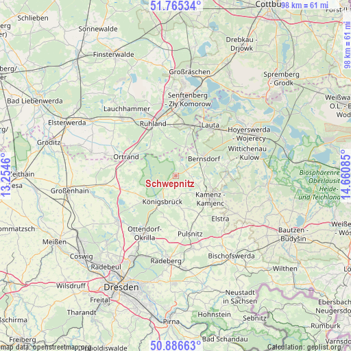
Schwepnitz GPS coordinates[2]
51° 19' 41.124" North, 13° 57' 27.792" East
| Map corner | latitude | longitude |
|---|---|---|
| Upper-left | 51.76534°, | 13.2546° |
| Center: | 51.32809°, | 13.95772° |
| Lower-right: | 50.88663°, | 14.66085° |
| Map W x H: | 97.7×97.7 km | = 60.7×60.7mi |
| max Lat: | 55.01917° ⇑36.3% North |
| Schwepnitz: | 51.32809° |
| min Lat: | ⇓63.7% South 47.40724° |
| min Long | Schwepnitz | max Long |
| 5.92978° | 13.95772° | 14.98853° |
| W 97.8%⇐ | ⇒2.2% E |
Elevation
Elevation of Schwepnitz is 147 m = 482 ft, and this is 102.1 m = 335 ft below average elevation for this country.
| Max E: |
1256 m = 4121 ft | 60.7% |
| Avg. | 249.1 m = 817 ft | |
| Schwepnitz | 147 m = 482 ft | |
Min E: |
-5 m = -16 ft | 39.3% |
See also: Germany elevation on elevation.city.
Geographical zone
Schwepnitz is located in North temperate zone (between Tropic of Cancer and the Arctic Circle). Distance of this North polar circle is 1694 km =1052.6 mi to North.| Distance of | km | miles | from Schwepnitz |
|---|---|---|---|
| North Pole | 4299.9 | 2671.8 | to North |
| Arctic Circle | 1694 | 1052.6 | to North |
| Tropic Cancer | 3101.2 | 1927 | to South |
| Equator | 5707.1 | 3546.2 | to South |


Nearby cities:
15 places around Schwepnitz: (largest is in red/bold)
• Bernsdorf
9.2 km =5.7 mi,  56°
56°
• Grünewald
8.5 km =5.3 mi,  20°
20°
• Guteborn
10 km =6.2 mi,  350°
350°
• Haselbachtal
11.3 km =7 mi,  155°
155°
• Hermsdorf
9.7 km =6 mi,  332°
332°
• Hohenbocka
12 km =7.5 mi, 17°
• Höckendorf
12 km =7.5 mi,  196°
196°
• Kamenz
11.6 km =7.2 mi,  125°
125°
• Kroppen
12.6 km =7.8 mi,  299°
299°
• Königsbrück
8 km =5 mi,  207°
207°
• Laußnitz
10.1 km =6.3 mi, 210°
• Neukirch
5.3 km =3.3 mi, 160°
• Oberlichtenau
12.4 km =7.7 mi,  169°
169°
• Straßgräbchen
7.9 km =4.9 mi,  70°
70°
• Wiednitz
8 km =5 mi,  36°
36°
Sources, notices
• [Note1] Compared only with cities in Germany existing in our database
• [Src1] Map data: © OpenStreetMap contributors (CC-BY-SA)
• [Src2] Other city data from geonames.org with taken over terms of usage.
• [Src3] Geographical zone / Annual Mean Temperature by Robert A. Rohde @ Wikipedia
