Schwaikheim geodata
Schwaikheim (Baden-Württemberg) is a seat of a fourth-order administrative division; located in Germany in Europe/Berlin (GMT+2) time zone. With population of 9,295 people, there are 1740 cities with bigger population in this country. Compared to other cities in Germany, 84.4% of cities are located further ↑North; 60.1% of cities are located further →East and 56.2% of cities have lower elevation than Schwaikheim. Note1
Administrative division(s):
- Level 1: Baden-Württemberg
- Level 2: Regierungsbezirk Stuttgart
- Level 3: Rems-Murr-Kreis
- Level 4: Schwaikheim


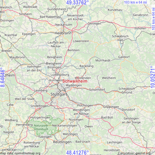
Schwaikheim GPS coordinates[2]
48° 52' 38.388" North, 9° 20' 58.488" East
| Map corner | latitude | longitude |
|---|---|---|
| Upper-left | 49.33762°, | 8.64646° |
| Center: | 48.87733°, | 9.34958° |
| Lower-right: | 48.41276°, | 10.05271° |
| Map W x H: | 102.8×102.8 km | = 63.9×63.9mi |
| max Lat: | 55.01917° ⇑84.4% North |
| Schwaikheim: | 48.87733° |
| min Lat: | ⇓15.6% South 47.40724° |
| min Long | Schwaikheim | max Long |
| 5.92978° | 9.34958° | 14.98853° |
| W 39.9%⇐ | ⇒60.1% E |
Elevation
Elevation of Schwaikheim is 267 m = 876 ft, and this is 17.9 m = 59 ft above average elevation for this country.
| Max E: |
1256 m = 4121 ft | 43.8% |
| Schwaikheim | 267 m 876 ft | |
| Avg. | 249.1 m = 817 ft | |
Min E: |
-5 m = -16 ft | 56.2% |
See also: Germany elevation on elevation.city.
Geographical zone
Schwaikheim is located in North temperate zone (between Tropic of Cancer and the Arctic Circle). Distance of this North polar circle is 1966.5 km =1221.9 mi to North.| Distance of | km | miles | from Schwaikheim |
|---|---|---|---|
| North Pole | 4572.4 | 2841.2 | to North |
| Arctic Circle | 1966.5 | 1221.9 | to North |
| Tropic Cancer | 2828.7 | 1757.7 | to South |
| Equator | 5434.6 | 3376.9 | to South |


Nearby cities:
15 places around Schwaikheim: (largest is in red/bold)
• Affalterbach
5.4 km =3.4 mi,  339°
339°
• Allmersbach im Tal
9.3 km =5.8 mi,  69°
69°
• Backnang
10.1 km =6.3 mi,  39°
39°
• Burgstetten
5.9 km =3.7 mi,  16°
16°
• Erdmannhausen
8.2 km =5.1 mi,  331°
331°
• Fellbach
9.3 km =5.8 mi,  215°
215°
• Kirchberg an der Murr
7.3 km =4.5 mi,  354°
354°
• Korb
3.9 km =2.4 mi,  165°
165°
• Leutenbach
3.4 km =2.1 mi, 69°
• Marbach am Neckar
9.5 km =5.9 mi,  316°
316°
• Mittelschöntal
8.3 km =5.2 mi, 23°
• Stuttgart Mühlhausen
9.6 km =6 mi,  245°
245°
• Waiblingen
5.6 km =3.5 mi,  205°
205°
• Weinstadt-Endersbach
7.2 km =4.5 mi, 171°
• Winnenden
3.6 km =2.2 mi,  93°
93°
Sources, notices
• [Note1] Compared only with cities in Germany existing in our database
• [Src1] Map data: © OpenStreetMap contributors (CC-BY-SA)
• [Src2] Other city data from geonames.org with taken over terms of usage.
• [Src3] Geographical zone / Annual Mean Temperature by Robert A. Rohde @ Wikipedia
