Burgstetten geodata
Burgstetten (Baden-Württemberg) is a seat of a fourth-order administrative division; located in Germany in Europe/Berlin (GMT+2) time zone. With population of 3,515 people, there are 3600 cities with bigger population in this country. Compared to other cities in Germany, 83.8% of cities are located further ↑North; 59.7% of cities are located further →East and 54.5% of cities have lower elevation than Burgstetten. Note1
Administrative division(s):
- Level 1: Baden-Württemberg
- Level 2: Regierungsbezirk Stuttgart
- Level 3: Rems-Murr-Kreis
- Level 4: Burgstetten


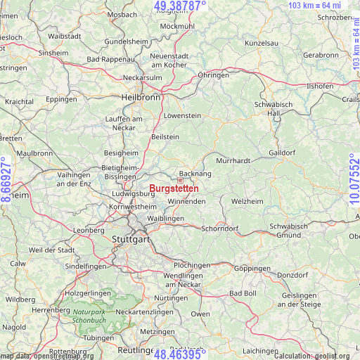
Burgstetten GPS coordinates[2]
48° 55' 40.98" North, 9° 22' 20.604" East
| Map corner | latitude | longitude |
|---|---|---|
| Upper-left | 49.38787°, | 8.66927° |
| Center: | 48.92805°, | 9.37239° |
| Lower-right: | 48.46395°, | 10.07552° |
| Map W x H: | 102.7×102.7 km | = 63.8×63.8mi |
| max Lat: | 55.01917° ⇑83.8% North |
| Burgstetten: | 48.92805° |
| min Lat: | ⇓16.2% South 47.40724° |
| min Long | Burgstetten | max Long |
| 5.92978° | 9.37239° | 14.98853° |
| W 40.3%⇐ | ⇒59.7% E |
Elevation
Elevation of Burgstetten is 255 m = 837 ft, and this is 5.9 m = 19 ft above average elevation for this country.
| Max E: |
1256 m = 4121 ft | 45.5% |
| Burgstetten | 255 m 837 ft | |
| Avg. | 249.1 m = 817 ft | |
Min E: |
-5 m = -16 ft | 54.5% |
See also: Germany elevation on elevation.city.
Geographical zone
Burgstetten is located in North temperate zone (between Tropic of Cancer and the Arctic Circle). Distance of this North polar circle is 1960.9 km =1218.4 mi to North.| Distance of | km | miles | from Burgstetten |
|---|---|---|---|
| North Pole | 4566.8 | 2837.7 | to North |
| Arctic Circle | 1960.9 | 1218.4 | to North |
| Tropic Cancer | 2834.4 | 1761.2 | to South |
| Equator | 5440.3 | 3380.4 | to South |


Nearby cities:
15 places around Burgstetten: (largest is in red/bold)
• Affalterbach
3.6 km =2.2 mi,  260°
260°
• Allmersbach im Tal
7.4 km =4.6 mi,  108°
108°
• Aspach
4.7 km =2.9 mi,  25°
25°
• Backnang
5.2 km =3.2 mi,  65°
65°
• Erdmannhausen
5.8 km =3.6 mi,  286°
286°
• Kirchberg an der Murr
2.8 km =1.7 mi,  305°
305°
• Korb
9.5 km =5.9 mi,  184°
184°
• Leutenbach
4.7 km =2.9 mi,  161°
161°
• Marbach am Neckar
8.3 km =5.2 mi,  278°
278°
• Mittelschöntal
2.6 km =1.6 mi,  39°
39°
• Murr
9.1 km =5.7 mi, 294°
• Oppenweiler
8.7 km =5.4 mi,  45°
45°
• Schwaikheim
5.9 km =3.7 mi,  196°
196°
• Steinheim am der Murr
8.3 km =5.2 mi,  302°
302°
• Winnenden
6.1 km =3.8 mi, 162°
Sources, notices
• [Note1] Compared only with cities in Germany existing in our database
• [Src1] Map data: © OpenStreetMap contributors (CC-BY-SA)
• [Src2] Other city data from geonames.org with taken over terms of usage.
• [Src3] Geographical zone / Annual Mean Temperature by Robert A. Rohde @ Wikipedia
