Leutenbach geodata
Leutenbach (Baden-Württemberg) is a seat of a fourth-order administrative division; located in Germany in Europe/Berlin (GMT+2) time zone. With population of 10,717 people, there are 1545 cities with bigger population in this country. Compared to other cities in Germany, 84.2% of cities are located further ↑North; 59.4% of cities are located further →East and 57.9% of cities have lower elevation than Leutenbach. Note1
Administrative division(s):
- Level 1: Baden-Württemberg
- Level 2: Regierungsbezirk Stuttgart
- Level 3: Rems-Murr-Kreis
- Level 4: Leutenbach


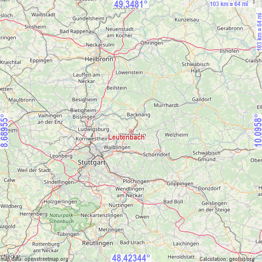
Leutenbach GPS coordinates[2]
48° 53' 16.476" North, 9° 23' 33.612" East
| Map corner | latitude | longitude |
|---|---|---|
| Upper-left | 49.3481°, | 8.68955° |
| Center: | 48.88791°, | 9.39267° |
| Lower-right: | 48.42344°, | 10.0958° |
| Map W x H: | 102.8×102.8 km | = 63.9×63.9mi |
| max Lat: | 55.01917° ⇑84.2% North |
| Leutenbach: | 48.88791° |
| min Lat: | ⇓15.8% South 47.40724° |
| min Long | Leutenbach | max Long |
| 5.92978° | 9.39267° | 14.98853° |
| W 40.6%⇐ | ⇒59.4% E |
Elevation
Elevation of Leutenbach is 278 m = 912 ft, and this is 28.9 m = 95 ft above average elevation for this country.
| Max E: |
1256 m = 4121 ft | 42.1% |
| Leutenbach | 278 m 912 ft | |
| Avg. | 249.1 m = 817 ft | |
Min E: |
-5 m = -16 ft | 57.9% |
See also: Germany elevation on elevation.city.
Geographical zone
Leutenbach is located in North temperate zone (between Tropic of Cancer and the Arctic Circle). Distance of this North polar circle is 1965.3 km =1221.2 mi to North.| Distance of | km | miles | from Leutenbach |
|---|---|---|---|
| North Pole | 4571.2 | 2840.4 | to North |
| Arctic Circle | 1965.3 | 1221.2 | to North |
| Tropic Cancer | 2829.9 | 1758.4 | to South |
| Equator | 5435.8 | 3377.6 | to South |


Nearby cities:
15 places around Leutenbach: (largest is in red/bold)
• Affalterbach
6.4 km =4 mi,  307°
307°
• Allmersbach im Tal
5.9 km =3.7 mi,  69°
69°
• Aspach
8.8 km =5.5 mi,  3°
3°
• Backnang
7.4 km =4.6 mi,  26°
26°
• Burgstetten
4.7 km =2.9 mi,  341°
341°
• Erdmannhausen
9.3 km =5.8 mi, 310°
• Kirchberg an der Murr
7.2 km =4.5 mi,  328°
328°
• Korb
5.5 km =3.4 mi,  203°
203°
• Marbach am Neckar
11.3 km =7 mi,  300°
300°
• Mittelschöntal
6.5 km =4 mi, 1°
• Rudersberg
10 km =6.2 mi,  91°
91°
• Schwaikheim
3.4 km =2.1 mi,  249°
249°
• Waiblingen
8.3 km =5.2 mi,  222°
222°
• Weinstadt-Endersbach
8.6 km =5.3 mi,  194°
194°
• Winnenden
1.4 km =0.9 mi,  163°
163°
Sources, notices
• [Note1] Compared only with cities in Germany existing in our database
• [Src1] Map data: © OpenStreetMap contributors (CC-BY-SA)
• [Src2] Other city data from geonames.org with taken over terms of usage.
• [Src3] Geographical zone / Annual Mean Temperature by Robert A. Rohde @ Wikipedia
