Affalterbach geodata
Affalterbach (Baden-Württemberg) is a seat of a fourth-order administrative division; located in Germany in Europe/Berlin (GMT+2) time zone. With population of 4,623 people, there are 2978 cities with bigger population in this country. Compared to other cities in Germany, 83.8% of cities are located further ↑North; 60.4% of cities are located further →East and 63.6% of cities have lower elevation than Affalterbach. Note1
Administrative division(s):
- Level 1: Baden-Württemberg
- Level 2: Regierungsbezirk Stuttgart
- Level 3: Landkreis Ludwigsburg
- Level 4: Affalterbach


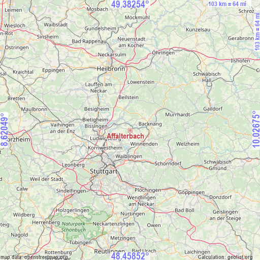
Affalterbach GPS coordinates[2]
48° 55' 21.612" North, 9° 19' 25.032" East
| Map corner | latitude | longitude |
|---|---|---|
| Upper-left | 49.38254°, | 8.62049° |
| Center: | 48.92267°, | 9.32362° |
| Lower-right: | 48.45852°, | 10.02675° |
| Map W x H: | 102.7×102.7 km | = 63.8×63.8mi |
| max Lat: | 55.01917° ⇑83.8% North |
| Affalterbach: | 48.92267° |
| min Lat: | ⇓16.2% South 47.40724° |
| min Long | Affalterbach | max Long |
| 5.92978° | 9.32362° | 14.98853° |
| W 39.6%⇐ | ⇒60.4% E |
Elevation
Elevation of Affalterbach is 312 m = 1024 ft, and this is 62.9 m = 206 ft above average elevation for this country.
| Max E: |
1256 m = 4121 ft | 36.4% |
| Affalterbach | 312 m 1024 ft | |
| Avg. | 249.1 m = 817 ft | |
Min E: |
-5 m = -16 ft | 63.6% |
See also: Germany elevation on elevation.city.
Geographical zone
Affalterbach is located in North temperate zone (between Tropic of Cancer and the Arctic Circle). Distance of this North polar circle is 1961.5 km =1218.8 mi to North.| Distance of | km | miles | from Affalterbach |
|---|---|---|---|
| North Pole | 4567.4 | 2838 | to North |
| Arctic Circle | 1961.5 | 1218.8 | to North |
| Tropic Cancer | 2833.8 | 1760.8 | to South |
| Equator | 5439.7 | 3380.1 | to South |


Nearby cities:
15 places around Affalterbach: (largest is in red/bold)
• Aspach
7.4 km =4.6 mi,  48°
48°
• Backnang
8.7 km =5.4 mi,  71°
71°
• Benningen am Neckar
6.5 km =4 mi,  294°
294°
• Burgstetten
3.6 km =2.2 mi,  80°
80°
• Erdmannhausen
3 km =1.9 mi,  317°
317°
• Freiberg am Neckar
8.9 km =5.5 mi,  276°
276°
• Großbottwar
9 km =5.6 mi,  345°
345°
• Kirchberg an der Murr
2.6 km =1.6 mi,  29°
29°
• Leutenbach
6.4 km =4 mi,  127°
127°
• Marbach am Neckar
5 km =3.1 mi, 292°
• Mittelschöntal
5.8 km =3.6 mi,  63°
63°
• Murr
6.4 km =4 mi,  312°
312°
• Schwaikheim
5.4 km =3.4 mi,  159°
159°
• Steinheim am der Murr
6.1 km =3.8 mi,  326°
326°
• Winnenden
7.6 km =4.7 mi, 133°
Sources, notices
• [Note1] Compared only with cities in Germany existing in our database
• [Src1] Map data: © OpenStreetMap contributors (CC-BY-SA)
• [Src2] Other city data from geonames.org with taken over terms of usage.
• [Src3] Geographical zone / Annual Mean Temperature by Robert A. Rohde @ Wikipedia
