Schraden geodata
Schraden (Brandenburg) is a seat of a fourth-order administrative division; located in Germany in Europe/Berlin (GMT+2) time zone. With population of 598 people, there are 8837 cities with bigger population in this country. Compared to other cities in Germany, 65.2% of cities are located further ↓South; 96.8% of cities are located further ←West and 69.5% of cities have higher elevation than Schraden. Note1


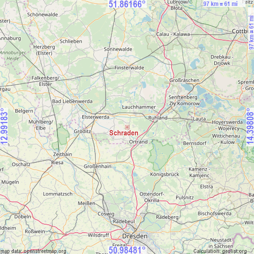
Schraden GPS coordinates[2]
51° 25' 31.224" North, 13° 41' 41.82" East
| Map corner | latitude | longitude |
|---|---|---|
| Upper-left | 51.86166°, | 12.99183° |
| Center: | 51.42534°, | 13.69495° |
| Lower-right: | 50.98481°, | 14.39808° |
| Map W x H: | 97.5×97.5 km | = 60.6×60.6mi |
| max Lat: | 55.01917° ⇑34.8% North |
| Schraden: | 51.42534° |
| min Lat: | ⇓65.2% South 47.40724° |
| min Long | Schraden | max Long |
| 5.92978° | 13.69495° | 14.98853° |
| W 96.8%⇐ | ⇒3.2% E |
Elevation
Elevation of Schraden is 94 m = 308 ft, and this is 155.1 m = 509 ft below average elevation for this country.
| Max E: |
1256 m = 4121 ft | 69.5% |
| Avg. | 249.1 m = 817 ft | |
| Schraden | 94 m = 308 ft | |
Min E: |
-5 m = -16 ft | 30.5% |
See also: Germany elevation on elevation.city.
Geographical zone
Schraden is located in North temperate zone (between Tropic of Cancer and the Arctic Circle). Distance of this North polar circle is 1683.2 km =1045.9 mi to North.| Distance of | km | miles | from Schraden |
|---|---|---|---|
| North Pole | 4289.1 | 2665.1 | to North |
| Arctic Circle | 1683.2 | 1045.9 | to North |
| Tropic Cancer | 3112 | 1933.7 | to South |
| Equator | 5718 | 3553 | to South |


Nearby cities:
15 places around Schraden: (largest is in red/bold)
• Elsterwerda
12.7 km =7.9 mi,  287°
287°
• Frauendorf
5.3 km =3.3 mi,  102°
102°
• Großkmehlen
5.6 km =3.5 mi,  157°
157°
• Großthiemig
5.1 km =3.2 mi,  202°
202°
• Gröden
9.3 km =5.8 mi,  252°
252°
• Hirschfeld
7.2 km =4.5 mi,  229°
229°
• Kroppen
8.7 km =5.4 mi,  122°
122°
• Lauchhammer
8.6 km =5.3 mi,  35°
35°
• Lindenau
3.9 km =2.4 mi,  136°
136°
• Merzdorf
11.6 km =7.2 mi,  255°
255°
• Ortrand
7.2 km =4.5 mi, 141°
• Plessa
7.1 km =4.4 mi,  310°
310°
• Ruhland
12.4 km =7.7 mi,  73°
73°
• Schwarzheide
12.5 km =7.8 mi,  62°
62°
• Tettau
2.8 km =1.7 mi, 71°
Sources, notices
• [Note1] Compared only with cities in Germany existing in our database
• [Src1] Map data: © OpenStreetMap contributors (CC-BY-SA)
• [Src2] Other city data from geonames.org with taken over terms of usage.
• [Src3] Geographical zone / Annual Mean Temperature by Robert A. Rohde @ Wikipedia
