Frauendorf geodata
Frauendorf (Brandenburg) is a populated place; located in Germany in Europe/Berlin (GMT+2) time zone. With population of 824 people, there are 7807 cities with bigger population in this country. Compared to other cities in Germany, 65% of cities are located further ↓South; 97.2% of cities are located further ←West and 68.5% of cities have higher elevation than Frauendorf. Note1
Administrative division(s):
- Level 1: Brandenburg
- Level 3: Landkreis Oberspreewald-Lausitz
- Level 4: Frauendorf


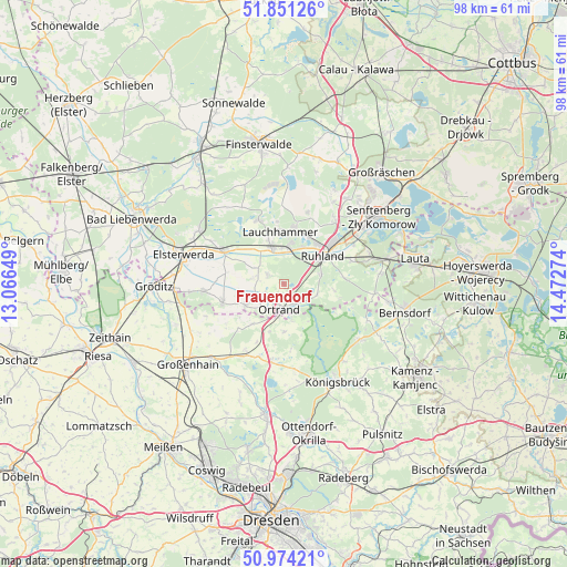
Frauendorf GPS coordinates[2]
51° 24' 53.424" North, 13° 46' 10.596" East
| Map corner | latitude | longitude |
|---|---|---|
| Upper-left | 51.85126°, | 13.06649° |
| Center: | 51.41484°, | 13.76961° |
| Lower-right: | 50.97421°, | 14.47274° |
| Map W x H: | 97.5×97.5 km | = 60.6×60.6mi |
| max Lat: | 55.01917° ⇑35% North |
| Frauendorf: | 51.41484° |
| min Lat: | ⇓65% South 47.40724° |
| min Long | Frauendorf | max Long |
| 5.92978° | 13.76961° | 14.98853° |
| W 97.2%⇐ | ⇒2.8% E |
Elevation
Elevation of Frauendorf is 100 m = 328 ft, and this is 149.1 m = 489 ft below average elevation for this country.
| Max E: |
1256 m = 4121 ft | 68.5% |
| Avg. | 249.1 m = 817 ft | |
| Frauendorf | 100 m = 328 ft | |
Min E: |
-5 m = -16 ft | 31.5% |
See also: Germany elevation on elevation.city.
Geographical zone
Frauendorf is located in North temperate zone (between Tropic of Cancer and the Arctic Circle). Distance of this North polar circle is 1684.4 km =1046.6 mi to North.| Distance of | km | miles | from Frauendorf |
|---|---|---|---|
| North Pole | 4290.3 | 2665.9 | to North |
| Arctic Circle | 1684.4 | 1046.6 | to North |
| Tropic Cancer | 3110.9 | 1933 | to South |
| Equator | 5716.8 | 3552.3 | to South |


Nearby cities:
15 places around Frauendorf: (largest is in red/bold)
• Großkmehlen
5 km =3.1 mi,  217°
217°
• Großthiemig
8 km =5 mi,  243°
243°
• Guteborn
11.4 km =7.1 mi,  88°
88°
• Hermsdorf
8.7 km =5.4 mi,  96°
96°
• Hirschfeld
11.2 km =7 mi,  251°
251°
• Kroppen
4.1 km =2.5 mi,  148°
148°
• Lauchhammer
8.2 km =5.1 mi,  358°
358°
• Lindenau
3 km =1.9 mi, 236°
• Ortrand
4.5 km =2.8 mi,  188°
188°
• Plessa
12.1 km =7.5 mi,  298°
298°
• Ruhland
8.2 km =5.1 mi,  54°
54°
• Schraden
5.3 km =3.3 mi,  282°
282°
• Schwarzbach
12 km =7.5 mi,  70°
70°
• Schwarzheide
9.1 km =5.7 mi,  40°
40°
• Tettau
3.2 km =2 mi,  309°
309°
Sources, notices
• [Note1] Compared only with cities in Germany existing in our database
• [Src1] Map data: © OpenStreetMap contributors (CC-BY-SA)
• [Src2] Other city data from geonames.org with taken over terms of usage.
• [Src3] Geographical zone / Annual Mean Temperature by Robert A. Rohde @ Wikipedia
