Schwarzheide geodata
Schwarzheide (Brandenburg) is a populated place; located in Germany in Europe/Berlin (GMT+2) time zone. With population of 6,646 people, there are 2265 cities with bigger population in this country. Compared to other cities in Germany, 66% of cities are located further ↓South; 97.4% of cities are located further ←West and 68.5% of cities have higher elevation than Schwarzheide. Note1
Administrative division(s):
- Level 1: Brandenburg
- Level 3: Landkreis Oberspreewald-Lausitz
- Level 4: Schwarzheide


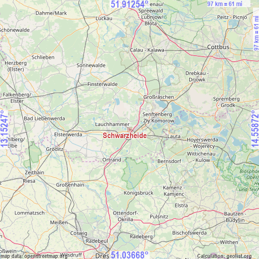
Schwarzheide GPS coordinates[2]
51° 28' 36.156" North, 13° 51' 20.124" East
| Map corner | latitude | longitude |
|---|---|---|
| Upper-left | 51.91254°, | 13.15247° |
| Center: | 51.47671°, | 13.85559° |
| Lower-right: | 51.03668°, | 14.55872° |
| Map W x H: | 97.4×97.4 km | = 60.5×60.5mi |
| max Lat: | 55.01917° ⇑34% North |
| Schwarzheide: | 51.47671° |
| min Lat: | ⇓66% South 47.40724° |
| min Long | Schwarzheide | max Long |
| 5.92978° | 13.85559° | 14.98853° |
| W 97.4%⇐ | ⇒2.6% E |
Elevation
Elevation of Schwarzheide is 100 m = 328 ft, and this is 149.1 m = 489 ft below average elevation for this country.
| Max E: |
1256 m = 4121 ft | 68.5% |
| Avg. | 249.1 m = 817 ft | |
| Schwarzheide | 100 m = 328 ft | |
Min E: |
-5 m = -16 ft | 31.5% |
See also: Germany elevation on elevation.city.
Geographical zone
Schwarzheide is located in North temperate zone (between Tropic of Cancer and the Arctic Circle). Distance of this North polar circle is 1677.5 km =1042.3 mi to North.| Distance of | km | miles | from Schwarzheide |
|---|---|---|---|
| North Pole | 4283.4 | 2661.6 | to North |
| Arctic Circle | 1677.5 | 1042.3 | to North |
| Tropic Cancer | 3117.8 | 1937.3 | to South |
| Equator | 5723.7 | 3556.5 | to South |


Nearby cities:
15 places around Schwarzheide: (largest is in red/bold)
• Frauendorf
9.1 km =5.7 mi,  220°
220°
• Guteborn
8.6 km =5.3 mi,  141°
141°
• Hermsdorf
8.3 km =5.2 mi,  161°
161°
• Hohenbocka
11.8 km =7.3 mi,  115°
115°
• Kroppen
11.1 km =6.9 mi,  200°
200°
• Lauchhammer
6.3 km =3.9 mi,  281°
281°
• Lindenau
12 km =7.5 mi, 224°
• Ortrand
13.1 km =8.1 mi,  210°
210°
• Ruhland
2.3 km =1.4 mi, 160°
• Sallgast
12.5 km =7.8 mi,  357°
357°
• Schipkau
5.4 km =3.4 mi,  32°
32°
• Schraden
12.5 km =7.8 mi,  242°
242°
• Schwarzbach
6.1 km =3.8 mi, 118°
• Senftenberg
11.5 km =7.1 mi,  61°
61°
• Tettau
9.7 km =6 mi, 240°
Sources, notices
• [Note1] Compared only with cities in Germany existing in our database
• [Src1] Map data: © OpenStreetMap contributors (CC-BY-SA)
• [Src2] Other city data from geonames.org with taken over terms of usage.
• [Src3] Geographical zone / Annual Mean Temperature by Robert A. Rohde @ Wikipedia
