Lauchhammer geodata
Lauchhammer (Brandenburg) is a populated place; located in Germany in Europe/Berlin (GMT+2) time zone. With population of 18,990 people, there are 824 cities with bigger population in this country. Compared to other cities in Germany, 66.1% of cities are located further ↓South; 97.1% of cities are located further ←West and 68.7% of cities have higher elevation than Lauchhammer. Note1
Administrative division(s):
- Level 1: Brandenburg
- Level 3: Landkreis Oberspreewald-Lausitz
- Level 4: Lauchhammer


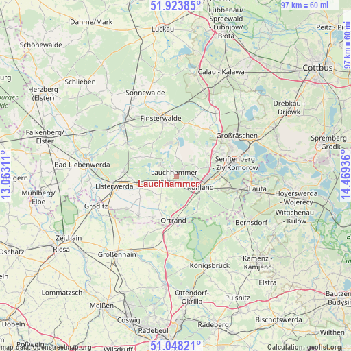
Lauchhammer GPS coordinates[2]
51° 29' 17.268" North, 13° 45' 58.428" East
| Map corner | latitude | longitude |
|---|---|---|
| Upper-left | 51.92385°, | 13.06311° |
| Center: | 51.48813°, | 13.76623° |
| Lower-right: | 51.04821°, | 14.46936° |
| Map W x H: | 97.4×97.4 km | = 60.5×60.5mi |
| max Lat: | 55.01917° ⇑33.9% North |
| Lauchhammer: | 51.48813° |
| min Lat: | ⇓66.1% South 47.40724° |
| min Long | Lauchhammer | max Long |
| 5.92978° | 13.76623° | 14.98853° |
| W 97.1%⇐ | ⇒2.9% E |
Elevation
Elevation of Lauchhammer is 99 m = 325 ft, and this is 150.1 m = 492 ft below average elevation for this country.
| Max E: |
1256 m = 4121 ft | 68.7% |
| Avg. | 249.1 m = 817 ft | |
| Lauchhammer | 99 m = 325 ft | |
Min E: |
-5 m = -16 ft | 31.3% |
See also: Germany elevation on elevation.city.
Geographical zone
Lauchhammer is located in North temperate zone (between Tropic of Cancer and the Arctic Circle). Distance of this North polar circle is 1676.2 km =1041.5 mi to North.| Distance of | km | miles | from Lauchhammer |
|---|---|---|---|
| North Pole | 4282.1 | 2660.8 | to North |
| Arctic Circle | 1676.2 | 1041.5 | to North |
| Tropic Cancer | 3119 | 1938.1 | to South |
| Equator | 5724.9 | 3557.3 | to South |


Nearby cities:
15 places around Lauchhammer: (largest is in red/bold)
• Frauendorf
8.2 km =5.1 mi,  178°
178°
• Großkmehlen
12.5 km =7.8 mi,  193°
193°
• Hermsdorf
12.7 km =7.9 mi,  136°
136°
• Kroppen
11.9 km =7.4 mi,  168°
168°
• Lichterfeld
12.2 km =7.6 mi,  3°
3°
• Lindenau
10.1 km =6.3 mi, 193°
• Ortrand
12.6 km =7.8 mi, 182°
• Plessa
10.6 km =6.6 mi,  257°
257°
• Ruhland
7.7 km =4.8 mi,  116°
116°
• Sallgast
12.6 km =7.8 mi,  26°
26°
• Schipkau
9.7 km =6 mi,  70°
70°
• Schraden
8.6 km =5.3 mi,  215°
215°
• Schwarzbach
12.3 km =7.6 mi,  110°
110°
• Schwarzheide
6.3 km =3.9 mi,  101°
101°
• Tettau
6.5 km =4 mi,  200°
200°
Sources, notices
• [Note1] Compared only with cities in Germany existing in our database
• [Src1] Map data: © OpenStreetMap contributors (CC-BY-SA)
• [Src2] Other city data from geonames.org with taken over terms of usage.
• [Src3] Geographical zone / Annual Mean Temperature by Robert A. Rohde @ Wikipedia
