Dotternhausen geodata
Dotternhausen (Baden-Württemberg) is a seat of a fourth-order administrative division; located in Germany in Europe/Berlin (GMT+2) time zone. With population of 1,784 people, there are 5371 cities with bigger population in this country. Compared to other cities in Germany, 92.3% of cities are located further ↑North; 68.1% of cities are located further →East and 96.7% of cities have lower elevation than Dotternhausen. Note1
Administrative division(s):
- Level 1: Baden-Württemberg
- Level 2: Tübingen Region
- Level 3: Zollernalbkreis
- Level 4: Dotternhausen


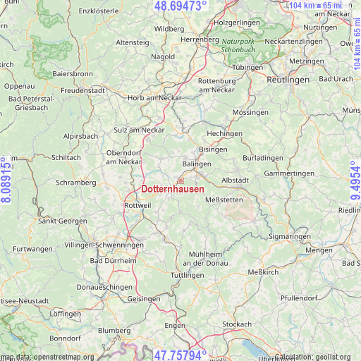
Dotternhausen GPS coordinates[2]
48° 13' 42.528" North, 8° 47' 32.208" East
| Map corner | latitude | longitude |
|---|---|---|
| Upper-left | 48.69473°, | 8.08915° |
| Center: | 48.22848°, | 8.79228° |
| Lower-right: | 47.75794°, | 9.4954° |
| Map W x H: | 104.2×104.2 km | = 64.7×64.7mi |
| max Lat: | 55.01917° ⇑92.3% North |
| Dotternhausen: | 48.22848° |
| min Lat: | ⇓7.7% South 47.40724° |
| min Long | Dotternhausen | max Long |
| 5.92978° | 8.79228° | 14.98853° |
| W 31.9%⇐ | ⇒68.1% E |
Elevation
Elevation of Dotternhausen is 650 m = 2133 ft, and this is 400.9 m = 1315 ft above average elevation for this country.
| Max E: |
1256 m = 4121 ft | 3.3% |
| Dotternhausen | 650 m 2133 ft | |
| Avg. | 249.1 m = 817 ft | |
Min E: |
-5 m = -16 ft | 96.7% |
See also: Germany elevation on elevation.city.
Geographical zone
Dotternhausen is located in North temperate zone (between Tropic of Cancer and the Arctic Circle). Distance of this North polar circle is 2038.7 km =1266.8 mi to North.| Distance of | km | miles | from Dotternhausen |
|---|---|---|---|
| North Pole | 4644.6 | 2886 | to North |
| Arctic Circle | 2038.7 | 1266.8 | to North |
| Tropic Cancer | 2756.6 | 1712.9 | to South |
| Equator | 5362.5 | 3332.1 | to South |


Nearby cities:
15 places around Dotternhausen: (largest is in red/bold)
• Balingen
7 km =4.3 mi,  41°
41°
• Dautmergen
4.1 km =2.5 mi,  291°
291°
• Deilingen
6.1 km =3.8 mi,  184°
184°
• Dietingen
11 km =6.8 mi,  256°
256°
• Dormettingen
1.7 km =1.1 mi,  303°
303°
• Geislingen
6.7 km =4.2 mi,  12°
12°
• Gosheim
10.8 km =6.7 mi,  195°
195°
• Hausen am Tann
4.7 km =2.9 mi,  135°
135°
• Obernheim
8.9 km =5.5 mi, 144°
• Ratshausen
3.9 km =2.4 mi, 176°
• Rosenfeld
8.2 km =5.1 mi,  321°
321°
• Schömberg
3.2 km =2 mi,  229°
229°
• Wehingen
9.2 km =5.7 mi, 180°
• Weilen unter den Rinnen
4.8 km =3 mi,  205°
205°
• Zimmern unter der Burg
5.5 km =3.4 mi, 260°
Sources, notices
• [Note1] Compared only with cities in Germany existing in our database
• [Src1] Map data: © OpenStreetMap contributors (CC-BY-SA)
• [Src2] Other city data from geonames.org with taken over terms of usage.
• [Src3] Geographical zone / Annual Mean Temperature by Robert A. Rohde @ Wikipedia
