Rosenfeld geodata
Rosenfeld (Baden-Württemberg) is a populated place; located in Germany in Europe/Berlin (GMT+2) time zone. With population of 6,405 people, there are 2332 cities with bigger population in this country. Compared to other cities in Germany, 91.4% of cities are located further ↑North; 68.8% of cities are located further →East and 96.1% of cities have lower elevation than Rosenfeld. Note1
Administrative division(s):
- Level 1: Baden-Württemberg
- Level 2: Tübingen Region
- Level 3: Zollernalbkreis
- Level 4: Rosenfeld


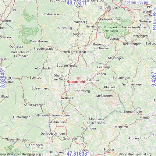
Rosenfeld GPS coordinates[2]
48° 17' 11.004" North, 8° 43' 24.852" East
| Map corner | latitude | longitude |
|---|---|---|
| Upper-left | 48.75211°, | 8.02045° |
| Center: | 48.28639°, | 8.72357° |
| Lower-right: | 47.81638°, | 9.4267° |
| Map W x H: | 104×104 km | = 64.6×64.6mi |
| max Lat: | 55.01917° ⇑91.4% North |
| Rosenfeld: | 48.28639° |
| min Lat: | ⇓8.6% South 47.40724° |
| min Long | Rosenfeld | max Long |
| 5.92978° | 8.72357° | 14.98853° |
| W 31.2%⇐ | ⇒68.8% E |
Elevation
Elevation of Rosenfeld is 630 m = 2067 ft, and this is 380.9 m = 1250 ft above average elevation for this country.
| Max E: |
1256 m = 4121 ft | 3.9% |
| Rosenfeld | 630 m 2067 ft | |
| Avg. | 249.1 m = 817 ft | |
Min E: |
-5 m = -16 ft | 96.1% |
See also: Germany elevation on elevation.city.
Geographical zone
Rosenfeld is located in North temperate zone (between Tropic of Cancer and the Arctic Circle). Distance of this North polar circle is 2032.2 km =1262.8 mi to North.| Distance of | km | miles | from Rosenfeld |
|---|---|---|---|
| North Pole | 4638.1 | 2882 | to North |
| Arctic Circle | 2032.2 | 1262.8 | to North |
| Tropic Cancer | 2763 | 1716.8 | to South |
| Equator | 5368.9 | 3336.1 | to South |


Nearby cities:
15 places around Rosenfeld: (largest is in red/bold)
• Balingen
9.8 km =6.1 mi,  97°
97°
• Dautmergen
5.1 km =3.2 mi,  165°
165°
• Dietingen
10.6 km =6.6 mi,  211°
211°
• Dormettingen
6.6 km =4.1 mi,  146°
146°
• Dotternhausen
8.2 km =5.1 mi,  141°
141°
• Epfendorf
10 km =6.2 mi,  246°
246°
• Geislingen
6.6 km =4.1 mi,  88°
88°
• Haigerloch
10.7 km =6.6 mi,  33°
33°
• Mühlheim am Bach
10.4 km =6.5 mi,  349°
349°
• Oberndorf
11.2 km =7 mi,  272°
272°
• Schömberg
8.9 km =5.5 mi,  162°
162°
• Sulz am Neckar
10.8 km =6.7 mi,  321°
321°
• Vöhringen
6.9 km =4.3 mi, 320°
• Weilen unter den Rinnen
11.2 km =7 mi, 164°
• Zimmern unter der Burg
7.3 km =4.5 mi,  182°
182°
Sources, notices
• [Note1] Compared only with cities in Germany existing in our database
• [Src1] Map data: © OpenStreetMap contributors (CC-BY-SA)
• [Src2] Other city data from geonames.org with taken over terms of usage.
• [Src3] Geographical zone / Annual Mean Temperature by Robert A. Rohde @ Wikipedia
