Schindhard geodata
Schindhard (Rheinland-Pfalz) is a seat of a fourth-order administrative division; located in Germany in Europe/Berlin (GMT+2) time zone. With population of 634 people, there are 8623 cities with bigger population in this country. Compared to other cities in Germany, 81.3% of cities are located further ↑North; 80.5% of cities are located further →East and 50.3% of cities have higher elevation than Schindhard. Note1


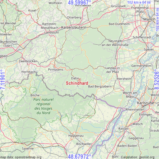
Schindhard GPS coordinates[2]
49° 8' 30.588" North, 7° 49' 19.704" East
| Map corner | latitude | longitude |
|---|---|---|
| Upper-left | 49.59967°, | 7.11901° |
| Center: | 49.14183°, | 7.82214° |
| Lower-right: | 48.67972°, | 8.52526° |
| Map W x H: | 102.3×102.3 km | = 63.6×63.6mi |
| max Lat: | 55.01917° ⇑81.3% North |
| Schindhard: | 49.14183° |
| min Lat: | ⇓18.7% South 47.40724° |
| min Long | Schindhard | max Long |
| 5.92978° | 7.82214° | 14.98853° |
| W 19.5%⇐ | ⇒80.5% E |
Elevation
Elevation of Schindhard is 223 m = 732 ft, and this is 26.1 m = 86 ft below average elevation for this country.
| Max E: |
1256 m = 4121 ft | 50.3% |
| Avg. | 249.1 m = 817 ft | |
| Schindhard | 223 m = 732 ft | |
Min E: |
-5 m = -16 ft | 49.7% |
See also: Germany elevation on elevation.city.
Geographical zone
Schindhard is located in North temperate zone (between Tropic of Cancer and the Arctic Circle). Distance of this North polar circle is 1937.1 km =1203.7 mi to North.| Distance of | km | miles | from Schindhard |
|---|---|---|---|
| North Pole | 4543 | 2822.9 | to North |
| Arctic Circle | 1937.1 | 1203.7 | to North |
| Tropic Cancer | 2858.1 | 1775.9 | to South |
| Equator | 5464.1 | 3395.2 | to South |


Nearby cities:
15 places around Schindhard: (largest is in red/bold)
• Bruchweiler-Bärenbach
3.2 km =2 mi,  209°
209°
• Bundenthal
5.2 km =3.2 mi,  190°
190°
• Busenberg
1.4 km =0.9 mi,  157°
157°
• Dahn
3.3 km =2.1 mi,  287°
287°
• Darstein
4.5 km =2.8 mi,  78°
78°
• Dimbach
6.3 km =3.9 mi,  63°
63°
• Erfweiler
1.8 km =1.1 mi,  337°
337°
• Hauenstein
6.1 km =3.8 mi,  23°
23°
• Lug
7.3 km =4.5 mi,  50°
50°
• Niederschlettenbach
6.8 km =4.2 mi, 162°
• Oberschlettenbach
3.6 km =2.2 mi, 82°
• Rumbach
5.6 km =3.5 mi, 206°
• Schwanheim
5.2 km =3.2 mi, 58°
• Spirkelbach
7.8 km =4.8 mi,  34°
34°
• Vorderweidenthal
4.6 km =2.9 mi,  101°
101°
Sources, notices
• [Note1] Compared only with cities in Germany existing in our database
• [Src1] Map data: © OpenStreetMap contributors (CC-BY-SA)
• [Src2] Other city data from geonames.org with taken over terms of usage.
• [Src3] Geographical zone / Annual Mean Temperature by Robert A. Rohde @ Wikipedia
