Sasbachwalden geodata
Sasbachwalden (Baden-Württemberg) is a seat of a fourth-order administrative division; located in Germany in Europe/Berlin (GMT+2) time zone. With population of 2,541 people, there are 4390 cities with bigger population in this country. Compared to other cities in Germany, 87.7% of cities are located further ↑North; 74.9% of cities are located further →East and 64.2% of cities have lower elevation than Sasbachwalden. Note1
Administrative division(s):
- Level 1: Baden-Württemberg
- Level 2: Freiburg Region
- Level 3: Ortenaukreis
- Level 4: Sasbachwalden


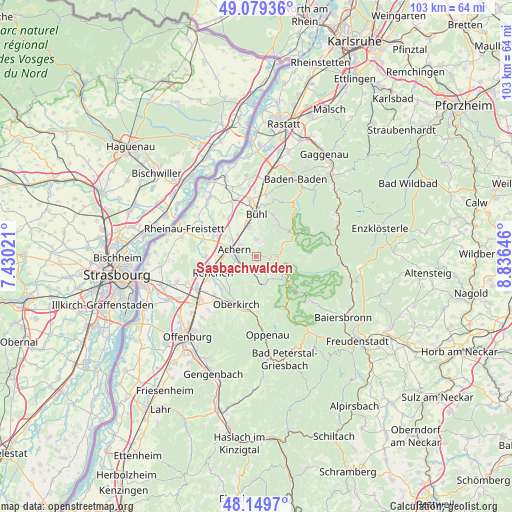
Sasbachwalden GPS coordinates[2]
48° 37' 0.012" North, 8° 7' 59.988" East
| Map corner | latitude | longitude |
|---|---|---|
| Upper-left | 49.07936°, | 7.43021° |
| Center: | 48.61667°, | 8.13333° |
| Lower-right: | 48.1497°, | 8.83646° |
| Map W x H: | 103.4×103.4 km | = 64.2×64.2mi |
| max Lat: | 55.01917° ⇑87.7% North |
| Sasbachwalden: | 48.61667° |
| min Lat: | ⇓12.3% South 47.40724° |
| min Long | Sasbachwalden | max Long |
| 5.92978° | 8.13333° | 14.98853° |
| W 25.1%⇐ | ⇒74.9% E |
Elevation
Elevation of Sasbachwalden is 316 m = 1037 ft, and this is 66.9 m = 219 ft above average elevation for this country.
| Max E: |
1256 m = 4121 ft | 35.8% |
| Sasbachwalden | 316 m 1037 ft | |
| Avg. | 249.1 m = 817 ft | |
Min E: |
-5 m = -16 ft | 64.2% |
See also: Germany elevation on elevation.city.
Geographical zone
Sasbachwalden is located in North temperate zone (between Tropic of Cancer and the Arctic Circle). Distance of this North polar circle is 1995.5 km =1239.9 mi to North.| Distance of | km | miles | from Sasbachwalden |
|---|---|---|---|
| North Pole | 4601.4 | 2859.2 | to North |
| Arctic Circle | 1995.5 | 1239.9 | to North |
| Tropic Cancer | 2799.7 | 1739.7 | to South |
| Equator | 5405.7 | 3358.9 | to South |


Nearby cities:
15 places around Sasbachwalden: (largest is in red/bold)
• Achern
4.5 km =2.8 mi,  290°
290°
• Biberach
10.6 km =6.6 mi,  93°
93°
• Bühl
8.9 km =5.5 mi,  0°
0°
• Bühlertal
8.7 km =5.4 mi,  27°
27°
• Haslach
8 km =5 mi,  224°
224°
• Kappelrodeck
3 km =1.9 mi,  203°
203°
• Lauf
3.7 km =2.3 mi, 0°
• Lautenbach
10.8 km =6.7 mi,  187°
187°
• Oberkirch
10.2 km =6.3 mi, 203°
• Ottenhöfen im Schwarzwald
5.7 km =3.5 mi,  167°
167°
• Ottersweier
6.1 km =3.8 mi,  346°
346°
• Renchen
9.4 km =5.8 mi,  250°
250°
• Sasbach
3.9 km =2.4 mi,  311°
311°
• Seebach
5.3 km =3.3 mi,  148°
148°
• Zell
9.9 km =6.2 mi,  328°
328°
Sources, notices
• [Note1] Compared only with cities in Germany existing in our database
• [Src1] Map data: © OpenStreetMap contributors (CC-BY-SA)
• [Src2] Other city data from geonames.org with taken over terms of usage.
• [Src3] Geographical zone / Annual Mean Temperature by Robert A. Rohde @ Wikipedia
