Lautenbach geodata
Lautenbach (Baden-Württemberg) is a seat of a fourth-order administrative division; located in Germany in Europe/Berlin (GMT+2) time zone. In our database, there are 11009 cities with bigger population. Compared to other cities in Germany, 88.9% of cities are located further ↑North; 75.2% of cities are located further →East and 51.3% of cities have higher elevation than Lautenbach. Note1
Administrative division(s):
- Level 1: Baden-Württemberg
- Level 2: Freiburg Region
- Level 3: Ortenaukreis
- Level 4: Lautenbach


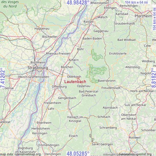
Lautenbach GPS coordinates[2]
48° 31' 14.556" North, 8° 6' 54.504" East
| Map corner | latitude | longitude |
|---|---|---|
| Upper-left | 48.98428°, | 7.41202° |
| Center: | 48.52071°, | 8.11514° |
| Lower-right: | 48.05285°, | 8.81827° |
| Map W x H: | 103.6×103.6 km | = 64.4×64.4mi |
| max Lat: | 55.01917° ⇑88.9% North |
| Lautenbach: | 48.52071° |
| min Lat: | ⇓11.1% South 47.40724° |
| min Long | Lautenbach | max Long |
| 5.92978° | 8.11514° | 14.98853° |
| W 24.8%⇐ | ⇒75.2% E |
Elevation
Elevation of Lautenbach is 216 m = 709 ft, and this is 33.1 m = 109 ft below average elevation for this country.
| Max E: |
1256 m = 4121 ft | 51.3% |
| Avg. | 249.1 m = 817 ft | |
| Lautenbach | 216 m = 709 ft | |
Min E: |
-5 m = -16 ft | 48.7% |
See also: Germany elevation on elevation.city.
Geographical zone
Lautenbach is located in North temperate zone (between Tropic of Cancer and the Arctic Circle). Distance of this North polar circle is 2006.2 km =1246.6 mi to North.| Distance of | km | miles | from Lautenbach |
|---|---|---|---|
| North Pole | 4612.1 | 2865.8 | to North |
| Arctic Circle | 2006.2 | 1246.6 | to North |
| Tropic Cancer | 2789.1 | 1733.1 | to South |
| Equator | 5395 | 3352.3 | to South |


Nearby cities:
15 places around Lautenbach: (largest is in red/bold)
• Achern
12.6 km =7.8 mi,  346°
346°
• Appenweier
9.8 km =6.1 mi,  278°
278°
• Bad Peterstal-Griesbach
12.3 km =7.6 mi,  142°
142°
• Durbach
7.8 km =4.8 mi,  247°
247°
• Haslach
6.6 km =4.1 mi,  319°
319°
• Kappelrodeck
7.9 km =4.9 mi,  0°
0°
• Lautenbach
7.8 km =4.8 mi,  236°
236°
• Oberkirch
3 km =1.9 mi,  295°
295°
• Ohlsbach
13.3 km =8.3 mi,  222°
222°
• Oppenau
6.2 km =3.9 mi,  148°
148°
• Ortenberg
13.1 km =8.1 mi,  233°
233°
• Ottenhöfen im Schwarzwald
5.7 km =3.5 mi,  26°
26°
• Renchen
10.6 km =6.6 mi, 315°
• Sasbachwalden
10.8 km =6.7 mi,  7°
7°
• Seebach
7.4 km =4.6 mi, 33°
Sources, notices
• [Note1] Compared only with cities in Germany existing in our database
• [Src1] Map data: © OpenStreetMap contributors (CC-BY-SA)
• [Src2] Other city data from geonames.org with taken over terms of usage.
• [Src3] Geographical zone / Annual Mean Temperature by Robert A. Rohde @ Wikipedia
