Samern geodata
Samern (Lower Saxony) is a populated locality; located in Germany in Europe/Berlin (GMT+2) time zone. With population of 722 people, there are 8225 cities with bigger population in this country. Compared to other cities in Germany, 75.1% of cities are located further ↓South; 90.6% of cities are located further →East and 81.4% of cities have higher elevation than Samern. Note1
Administrative division(s):
- Level 1: Lower Saxony
- Level 3: Landkreis Grafschaft Bentheim
- Level 4: Samern


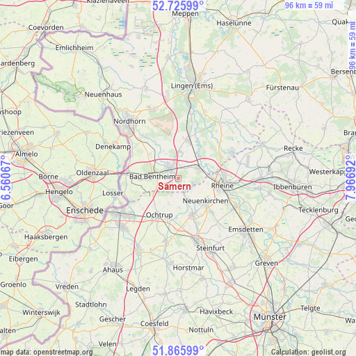
Samern GPS coordinates[2]
52° 17' 53.088" North, 7° 15' 49.68" East
| Map corner | latitude | longitude |
|---|---|---|
| Upper-left | 52.72599°, | 6.56067° |
| Center: | 52.29808°, | 7.2638° |
| Lower-right: | 51.86599°, | 7.96692° |
| Map W x H: | 95.6×95.6 km | = 59.4×59.4mi |
| max Lat: | 55.01917° ⇑24.9% North |
| Samern: | 52.29808° |
| min Lat: | ⇓75.1% South 47.40724° |
| min Long | Samern | max Long |
| 5.92978° | 7.2638° | 14.98853° |
| W 9.4%⇐ | ⇒90.6% E |
Elevation
Elevation of Samern is 43 m = 141 ft, and this is 206.1 m = 676 ft below average elevation for this country.
| Max E: |
1256 m = 4121 ft | 81.4% |
| Avg. | 249.1 m = 817 ft | |
| Samern | 43 m = 141 ft | |
Min E: |
-5 m = -16 ft | 18.6% |
See also: Germany elevation on elevation.city.
Geographical zone
Samern is located in North temperate zone (between Tropic of Cancer and the Arctic Circle). Distance of this North polar circle is 1586.2 km =985.6 mi to North.| Distance of | km | miles | from Samern |
|---|---|---|---|
| North Pole | 4192.1 | 2604.8 | to North |
| Arctic Circle | 1586.2 | 985.6 | to North |
| Tropic Cancer | 3209.1 | 1994 | to South |
| Equator | 5815 | 3613.3 | to South |


Nearby cities:
15 places around Samern: (largest is in red/bold)
• Bad Bentheim
7.2 km =4.5 mi,  272°
272°
• Dreierwalde
16.7 km =10.4 mi,  76°
76°
• Emsbüren
11.6 km =7.2 mi,  12°
12°
• Engden
12.6 km =7.8 mi,  334°
334°
• Isterberg
9.7 km =6 mi,  306°
306°
• Neuenkirchen
9.4 km =5.8 mi,  128°
128°
• Ochtrup
11.2 km =7 mi,  206°
206°
• Ohne
3.7 km =2.3 mi,  159°
159°
• Quendorf
6.7 km =4.2 mi, 305°
• Rheine
12.1 km =7.5 mi,  96°
96°
• Salzbergen
7 km =4.3 mi,  56°
56°
• Schüttorf
4 km =2.5 mi, 313°
• Spelle
15.8 km =9.8 mi, 61°
• Suddendorf
2.6 km =1.6 mi,  277°
277°
• Wettringen
10.6 km =6.6 mi, 159°
Sources, notices
• [Note1] Compared only with cities in Germany existing in our database
• [Src1] Map data: © OpenStreetMap contributors (CC-BY-SA)
• [Src2] Other city data from geonames.org with taken over terms of usage.
• [Src3] Geographical zone / Annual Mean Temperature by Robert A. Rohde @ Wikipedia
