Bad Bentheim geodata
Bad Bentheim (Lower Saxony) is a populated place; located in Germany in Europe/Berlin (GMT+2) time zone. With population of 15,508 people, there are 1033 cities with bigger population in this country. Compared to other cities in Germany, 75.2% of cities are located further ↓South; 91.8% of cities are located further →East and 75.8% of cities have higher elevation than Bad Bentheim. Note1
Administrative division(s):
- Level 1: Lower Saxony
- Level 3: Landkreis Grafschaft Bentheim
- Level 4: Bad Bentheim


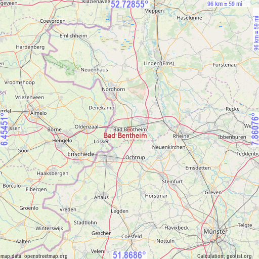
Bad Bentheim GPS coordinates[2]
52° 18' 2.376" North, 7° 9' 27.468" East
| Map corner | latitude | longitude |
|---|---|---|
| Upper-left | 52.72855°, | 6.45451° |
| Center: | 52.30066°, | 7.15763° |
| Lower-right: | 51.8686°, | 7.86076° |
| Map W x H: | 95.6×95.6 km | = 59.4×59.4mi |
| max Lat: | 55.01917° ⇑24.8% North |
| Bad Bentheim: | 52.30066° |
| min Lat: | ⇓75.2% South 47.40724° |
| min Long | Bad Bentheim | max Long |
| 5.92978° | 7.15763° | 14.98853° |
| W 8.2%⇐ | ⇒91.8% E |
Elevation
Elevation of Bad Bentheim is 60 m = 197 ft, and this is 189.1 m = 620 ft below average elevation for this country.
| Max E: |
1256 m = 4121 ft | 75.8% |
| Avg. | 249.1 m = 817 ft | |
| Bad Bentheim | 60 m = 197 ft | |
Min E: |
-5 m = -16 ft | 24.2% |
See also: Germany elevation on elevation.city.
Geographical zone
Bad Bentheim is located in North temperate zone (between Tropic of Cancer and the Arctic Circle). Distance of this North polar circle is 1585.9 km =985.4 mi to North.| Distance of | km | miles | from Bad Bentheim |
|---|---|---|---|
| North Pole | 4191.8 | 2604.7 | to North |
| Arctic Circle | 1585.9 | 985.4 | to North |
| Tropic Cancer | 3209.4 | 1994.2 | to South |
| Equator | 5815.3 | 3613.5 | to South |


Nearby cities:
15 places around Bad Bentheim: (largest is in red/bold)
• Emsbüren
14.7 km =9.1 mi,  41°
41°
• Engden
11.2 km =7 mi,  8°
8°
• Gronau
13.6 km =8.5 mi,  222°
222°
• Isterberg
5.5 km =3.4 mi,  354°
354°
• Metelen
17.8 km =11.1 mi,  167°
167°
• Neuenkirchen
15.8 km =9.8 mi,  113°
113°
• Nordhorn
15.7 km =9.8 mi,  337°
337°
• Ochtrup
10.5 km =6.5 mi, 167°
• Ohne
9.3 km =5.8 mi, 113°
• Quendorf
4 km =2.5 mi,  25°
25°
• Salzbergen
13.6 km =8.5 mi,  74°
74°
• Samern
7.2 km =4.5 mi,  92°
92°
• Schüttorf
5 km =3.1 mi,  60°
60°
• Suddendorf
4.6 km =2.9 mi, 89°
• Wettringen
15 km =9.3 mi,  132°
132°
Sources, notices
• [Note1] Compared only with cities in Germany existing in our database
• [Src1] Map data: © OpenStreetMap contributors (CC-BY-SA)
• [Src2] Other city data from geonames.org with taken over terms of usage.
• [Src3] Geographical zone / Annual Mean Temperature by Robert A. Rohde @ Wikipedia
