Burgdorf geodata
Burgdorf (Lower Saxony) is a seat of a fourth-order administrative division; located in Germany in Europe/Berlin (GMT+2) time zone. In our database, there are 11009 cities with bigger population. Compared to other cities in Germany, 73.5% of cities are located further ↓South; 53.7% of cities are located further ←West and 66.3% of cities have higher elevation than Burgdorf. Note1


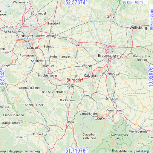
Burgdorf GPS coordinates[2]
52° 8' 39.624" North, 10° 13' 3.468" East
| Map corner | latitude | longitude |
|---|---|---|
| Upper-left | 52.57374°, | 9.5145° |
| Center: | 52.14434°, | 10.21763° |
| Lower-right: | 51.71076°, | 10.92076° |
| Map W x H: | 96×96 km | = 59.7×59.7mi |
| max Lat: | 55.01917° ⇑26.5% North |
| Burgdorf: | 52.14434° |
| min Lat: | ⇓73.5% South 47.40724° |
| min Long | Burgdorf | max Long |
| 5.92978° | 10.21763° | 14.98853° |
| W 53.7%⇐ | ⇒46.3% E |
Elevation
Elevation of Burgdorf is 112 m = 367 ft, and this is 137.1 m = 450 ft below average elevation for this country.
| Max E: |
1256 m = 4121 ft | 66.3% |
| Avg. | 249.1 m = 817 ft | |
| Burgdorf | 112 m = 367 ft | |
Min E: |
-5 m = -16 ft | 33.7% |
See also: Germany elevation on elevation.city.
Geographical zone
Burgdorf is located in North temperate zone (between Tropic of Cancer and the Arctic Circle). Distance of this North polar circle is 1603.3 km =996.2 mi to North.| Distance of | km | miles | from Burgdorf |
|---|---|---|---|
| North Pole | 4209.2 | 2615.5 | to North |
| Arctic Circle | 1603.3 | 996.2 | to North |
| Tropic Cancer | 3192 | 1983.4 | to South |
| Equator | 5797.9 | 3602.6 | to South |


Nearby cities:
15 places around Burgdorf: (largest is in red/bold)
• Alt Wallmoden
15.1 km =9.4 mi,  157°
157°
• Baddeckenstedt
6.9 km =4.3 mi,  171°
171°
• Bockenem
16.1 km =10 mi,  201°
201°
• Cramme
16 km =9.9 mi,  102°
102°
• Elbe
8.1 km =5 mi,  146°
146°
• Haverlah
9.3 km =5.8 mi, 201°
• Heere
8.9 km =5.5 mi, 165°
• Holle
7.5 km =4.7 mi,  211°
211°
• Ilsede
13.3 km =8.3 mi,  354°
354°
• Lengede
9.1 km =5.7 mi,  42°
42°
• Salzgitter
13.6 km =8.5 mi,  84°
84°
• Schellerten
9.1 km =5.7 mi,  300°
300°
• Sehlde
12.2 km =7.6 mi, 164°
• Söhlde
5.1 km =3.2 mi,  11°
11°
• Vechelde
16.3 km =10.1 mi, 37°
Sources, notices
• [Note1] Compared only with cities in Germany existing in our database
• [Src1] Map data: © OpenStreetMap contributors (CC-BY-SA)
• [Src2] Other city data from geonames.org with taken over terms of usage.
• [Src3] Geographical zone / Annual Mean Temperature by Robert A. Rohde @ Wikipedia
